Polo, Dominican Republic
Polo is a municipality of the Barahona Province in southwestern Dominican Republic, known for its green and high mountains and for growing fine coffee.
Polo | |
|---|---|
 Polo | |
| Coordinates: 18°04′48″N 71°16′48″W | |
| Country | Dominican Republic |
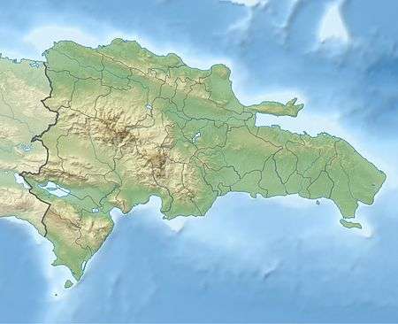
| Province | Barahona |
| Area | |
| • Total | 200.61 km2 (77.46 sq mi) |
| Elevation | 746 m (2,448 ft) |
| Population (2012) | |
| • Total | 7,144 |
| • Density | 36/km2 (92/sq mi) |
The small town of Polo is also known for having El Polo Magnético (the magnetic pole), an area on a mountain near the village. If a car is stopped at the right place, and put in neutral, the car seems to be rolling up the hill. This is type of optical illusion known as a gravity hill which is caused by the shape of the slope and the surrounding landscape.
Climate
| Month | Jan | Feb | Mar | Apr | May | Jun | Jul | Aug | Sep | Oct | Nov | Dec | Year |
|---|---|---|---|---|---|---|---|---|---|---|---|---|---|
| Record high °C (°F) | 33.8 (92.8) |
33.2 (91.8) |
32.4 (90.3) |
32.0 (89.6) |
31.0 (87.8) |
31.2 (88.2) |
32.2 (90.0) |
32.4 (90.3) |
34.9 (94.8) |
35.2 (95.4) |
34.2 (93.6) |
33.6 (92.5) |
35.2 (95.4) |
| Average high °C (°F) | 25.8 (78.4) |
26.1 (79.0) |
26.5 (79.7) |
27.1 (80.8) |
27.0 (80.6) |
26.9 (80.4) |
27.4 (81.3) |
27.8 (82.0) |
28.1 (82.6) |
27.6 (81.7) |
27.3 (81.1) |
26.3 (79.3) |
27.0 (80.6) |
| Daily mean °C (°F) | 23.2 (73.8) |
23.1 (73.6) |
23.6 (74.5) |
24.6 (76.3) |
25.6 (78.1) |
26.3 (79.3) |
26.9 (80.4) |
26.8 (80.2) |
26.7 (80.1) |
26.2 (79.2) |
24.9 (76.8) |
23.6 (74.5) |
25.1 (77.2) |
| Average low °C (°F) | 13.5 (56.3) |
13.7 (56.7) |
14.4 (57.9) |
15.4 (59.7) |
16.6 (61.9) |
17.3 (63.1) |
17.3 (63.1) |
17.1 (62.8) |
16.9 (62.4) |
16.5 (61.7) |
15.5 (59.9) |
13.9 (57.0) |
15.7 (60.3) |
| Record low °C (°F) | 0.5 (32.9) |
8.0 (46.4) |
8.5 (47.3) |
8.5 (47.3) |
11.2 (52.2) |
12.0 (53.6) |
10.0 (50.0) |
11.0 (51.8) |
11.9 (53.4) |
11.2 (52.2) |
10.0 (50.0) |
8.0 (46.4) |
0.5 (32.9) |
| Average rainfall mm (inches) | 64.7 (2.55) |
63.2 (2.49) |
68.1 (2.68) |
73.9 (2.91) |
195.0 (7.68) |
264.8 (10.43) |
180.4 (7.10) |
260.2 (10.24) |
265.6 (10.46) |
233.1 (9.18) |
132.5 (5.22) |
73.1 (2.88) |
1,874.6 (73.80) |
| Average rainy days (≥ 1.0 mm) | 8.6 | 7.5 | 8.5 | 9.4 | 15.0 | 16.2 | 12.6 | 13.2 | 12.1 | 13.3 | 9.3 | 7.7 | 133.4 |
| Average relative humidity (%) | 88.7 | 86.3 | 85.9 | 85.8 | 87.7 | 87.4 | 86.2 | 82.9 | 86.8 | 87.8 | 87.1 | 87.4 | 86.7 |
| Source 1: NOAA[1] | |||||||||||||
| Source 2: ONAMET,[2] Acqweather[3] | |||||||||||||
gollark: Füthārκ!
gollark: Futhark is cōōl.
gollark: Ah. No. PotatOS just lets me remotely send commands.
gollark: If they also had modems.
gollark: If you installed potatOS on them I would be able to remotely track them.
References
- "Polo Climate Normals 1961-1990". National Oceanic and Atmospheric Administration. Retrieved September 18, 2016.
- National Bureau of Meteorology (ONAMET). "Pronóstico Turístico Mensual" (in Spanish). Santo Domingo. Archived from the original on September 28, 2011. Retrieved June 6, 2011.
- Antonio Cocco Quezada. "TURISMO Y CLIMATOLOGIA" [Tourism & Climatology] (in Spanish). ACQ & Asociados. Archived from the original on September 12, 2011. Retrieved June 6, 2011.
External links
- Magnetic Hill International: Polo Magnético
- http://www.polomagnetico.com/ - Daily news of Polo (Spanish)
- http://www.williamramos.tv/blog/polo-un-pueblo-en-barahona-que-esconde-grandes-tesoros-conocias-alguno/ - Video of the hidden paradise of Polo
This article is issued from Wikipedia. The text is licensed under Creative Commons - Attribution - Sharealike. Additional terms may apply for the media files.