Pollard, Alabama
Pollard is a town in Escambia County, Alabama, United States. It was the first established county seat of Escambia County, from its creation in 1868 until 1883, when it lost that distinction to Brewton. At the 2010 census the population was 137.[3]
Pollard, Alabama | |
|---|---|
 Location of Pollard in Escambia County, Alabama. | |
| Coordinates: 31°1′38″N 87°10′20″W | |
| Country | United States |
| State | Alabama |
| County | Escambia |
| Area | |
| • Total | 1.11 sq mi (2.89 km2) |
| • Land | 1.11 sq mi (2.88 km2) |
| • Water | 0.00 sq mi (0.01 km2) |
| Elevation | 62 ft (19 m) |
| Population (2010) | |
| • Total | 137 |
| • Estimate (2019)[2] | 136 |
| • Density | 122.30/sq mi (47.22/km2) |
| Time zone | UTC-6 (Central (CST)) |
| • Summer (DST) | UTC-5 (CDT) |
| ZIP code | 36441 |
| Area code(s) | 251 |
| FIPS code | 01-61536 |
| GNIS feature ID | 0125105 |
Geography
Pollard is located in south-central Escambia County at 31°1′38″N 87°10′20″W (31.027340, -87.172342).[4] It is 1.5 miles (2.4 km) south and east of U.S. Routes 31 and 29, 6 miles (10 km) east of Flomaton, and 9 miles (14 km) southwest of Brewton.
According to the U.S. Census Bureau, the town has a total area of 1.1 square miles (2.9 km2), all land.[3]
Demographics
| Historical population | |||
|---|---|---|---|
| Census | Pop. | %± | |
| 1880 | 347 | — | |
| 1890 | 389 | 12.1% | |
| 1900 | 267 | −31.4% | |
| 1910 | 599 | 124.3% | |
| 1920 | 631 | 5.3% | |
| 1930 | 304 | −51.8% | |
| 1940 | 339 | 11.5% | |
| 1950 | 271 | −20.1% | |
| 1960 | 210 | −22.5% | |
| 1970 | 86 | −59.0% | |
| 1980 | 144 | 67.4% | |
| 1990 | 100 | −30.6% | |
| 2000 | 120 | 20.0% | |
| 2010 | 137 | 14.2% | |
| Est. 2019 | 136 | [2] | −0.7% |
| U.S. Decennial Census[5] | |||
As of the census[6] of 2000, there were 120 people, 48 households, and 33 families residing in the town. The population density was 107.6 people per square mile (41.7/km2). There were 64 housing units at an average density of 57.4 per square mile (22.3/km2). The racial makeup of the town was 51.67% White, 41.67% Black or African American, 1.67% Native American, 0.83% from other races, and 4.17% from two or more races. 1.67% of the population were Hispanic or Latino of any race.
There were 48 households, out of which 31.3% had children under the age of 18 living with them, 50.0% were married couples living together, 14.6% had a female householder with no husband present, and 29.2% were non-families. 29.2% of all households were made up of individuals, and 12.5% had someone living alone who was 65 years of age or older. The average household size was 2.50 and the average family size was 3.09.
In the town, the population was spread out, with 27.5% under the age of 18, 6.7% from 18 to 24, 22.5% from 25 to 44, 23.3% from 45 to 64, and 20.0% who were 65 years of age or older. The median age was 41 years. For every 100 females, there were 106.9 males. For every 100 females age 18 and over, there were 93.3 males.
The median income for a household in the town was $26,875, and the median income for a family was $28,750. Males had a median income of $41,250 versus $17,813 for females. The per capita income for the town was $11,410. There were 22.6% of families and 26.6% of the population living below the poverty line, including 36.4% of under eighteens and 30.4% of those over 64.
References
- "2019 U.S. Gazetteer Files". United States Census Bureau. Retrieved June 29, 2020.
- "Population and Housing Unit Estimates". United States Census Bureau. May 24, 2020. Retrieved May 27, 2020.
- "Geographic Identifiers: 2010 Demographic Profile Data (G001): Pollard town, Alabama". American Factfinder. U.S. Census Bureau. Archived from the original on February 13, 2020. Retrieved January 21, 2016.
- "US Gazetteer files: 2010, 2000, and 1990". United States Census Bureau. 2011-02-12. Retrieved 2011-04-23.
- "U.S. Decennial Census". Census.gov. Retrieved June 6, 2013.
- "U.S. Census website". United States Census Bureau. Retrieved 2008-01-31.
Municipalities and communities of Escambia County, Alabama, United States | ||
|---|---|---|
| Cities | 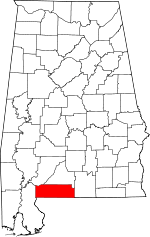 Map of Alabama highlighting Escambia County | |
| Towns | ||
| Unincorporated communities | ||
| Indian reservation | ||
| Former Town | ||
| Footnotes | ‡This populated place also has portions in an adjacent county or counties | |