Polanco, Zamboanga del Norte
Polanco, officially the Municipality of Polanco (Cebuano: Lungsod sa Polanco; Subanen: Benwa Polanco; Chavacano: Municipalidad de Polanco; Tagalog: Bayan ng Polanco), is a 3rd class municipality in the province of Zamboanga del Norte, Philippines. According to the 2015 census, it has a population of 39,347 people.[3]
Polanco | |
|---|---|
| Municipality of Polanco | |
| Nickname(s): Marang Capital of the Philippines | |
| Motto(s): Uswag Polanco | |
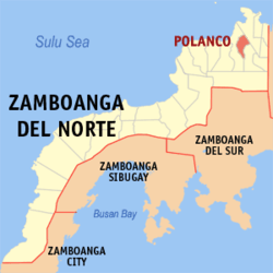
 Map of Zamboanga del Norte with Polanco highlighted | |
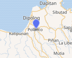
OpenStreetMap 
| |
.svg.png) Polanco Location within the Philippines | |
| Coordinates: 8°32′N 123°22′E | |
| Country | |
| Region | Zamboanga Peninsula (Region IX) |
| Province | Zamboanga del Norte |
| District | 1st District |
| Founded | August 22, 1951 |
| Barangays | 30 (see Barangays) |
| Government | |
| • Type | Sangguniang Bayan |
| • Mayor | Evan Hope D. Olvis |
| • Vice Mayor | Alfredo S. Bait-it |
| • Congressman | Romeo M. Jalosjos Jr. |
| • Electorate | 27,601 voters (2019) |
| Area | |
| • Total | 206.88 km2 (79.88 sq mi) |
| Population (2015 census)[3] | |
| • Total | 39,347 |
| • Density | 190/km2 (490/sq mi) |
| • Households | 9,109 |
| Economy | |
| • Income class | 3rd municipal income class |
| • Poverty incidence | 40.54% (2015)[4] |
| • Revenue (₱) | 106,996,789.42 (2016) |
| Time zone | UTC+8 (PST) |
| ZIP code | 7106 |
| PSGC | |
| IDD : area code | +63 (0)65 |
| Climate type | tropical climate |
| Native languages | Subanon language Cebuano Chavacano Tagalog |
| Website | polanco |
Most of land of Polanco was owned by the influential family of Realiza, led by Don Gaudencio N. Realiza during the times of American regime in the Philippines. The present land they own are large parts of Labrador (Prinda), Bethlehem, Dansullan, Guinles, Macleodes, New Sicayab, New Lebangon, Sianib, South Polanco, and Obay.
Barangays
Polanco is politically subdivided into 30 barangays. Lingasad, Silawe, Isis, and Loboc (present-day San Miguel) became barrios in 1954.[5] In 1955, the sitios of Prenda, Balangbang, Marantaw, Tamsi, Serabang Gamay and Serabang Daku became barrio Prenda, while sitios of Bandera, Pian, Biga-an, Upper Genatulan, Lower Sinaman and Miasi became barrio Bandera.[6]
In 1957, the sitios of Dilawa, Desin, Lambog, Gumatob, Boboringan, Tubongon, Debolok, Tiaman, Guintom, Lower Disoy, and New Tipan were converted into the barrio of Milad.[7]
- Anastacio
- Bandera
- Bethlehem
- Dangi
- Dansullan
- De Venta Perla
- Guinles
- Isis
- Labrador (Prinda)
- Lapayanbaja
- Letapan
- Linabo
- Lingasad
- Macleodes
- Magangon
- Maligaya
- Milad
- New Lebangon
- New Sicayab
- Obay
- Pian
- Poblacion North
- Poblacion South
- San Antonio (Paetan)
- San Miguel (Loboc)
- San Pedro
- Santo Niño (Lantoy)
- Sianib
- Silawe
- Villahermosa
Sianib is a rural village (barangay) located approximately twenty minutes by highway from Polanco. Community services include both an international primary school and high school, active Catholic and Christian evangelical congregations, and a small shopping district including video karaoke with many enthusiastic local singers. Sianib is also home to Barangay Brands International, a test marketing center for retail grocery product promotion and to Comfort of Home Homes, Inc., which is a housing cooperative. Most jobs are in agriculture ranging from rice to abundant seasonal fruit production including mangosteen, rambutan, coconut and banana. Other employers include a beauty products manufacturer, sawmill and a charcoal factory.
Climate
| Climate data for Polanco, Zamboanga del Norte | |||||||||||||
|---|---|---|---|---|---|---|---|---|---|---|---|---|---|
| Month | Jan | Feb | Mar | Apr | May | Jun | Jul | Aug | Sep | Oct | Nov | Dec | Year |
| Average high °C (°F) | 29 (84) |
29 (84) |
30 (86) |
31 (88) |
30 (86) |
30 (86) |
29 (84) |
30 (86) |
30 (86) |
29 (84) |
29 (84) |
29 (84) |
30 (85) |
| Average low °C (°F) | 23 (73) |
23 (73) |
23 (73) |
24 (75) |
25 (77) |
25 (77) |
24 (75) |
24 (75) |
24 (75) |
24 (75) |
24 (75) |
23 (73) |
24 (75) |
| Average precipitation mm (inches) | 104 (4.1) |
76 (3.0) |
92 (3.6) |
97 (3.8) |
199 (7.8) |
238 (9.4) |
195 (7.7) |
193 (7.6) |
178 (7.0) |
212 (8.3) |
171 (6.7) |
110 (4.3) |
1,865 (73.3) |
| Average rainy days | 14.7 | 12.5 | 15.8 | 17.5 | 27.6 | 28.5 | 29.0 | 27.5 | 26.9 | 27.9 | 23.5 | 18.2 | 269.6 |
| Source: Meteoblue [8] | |||||||||||||
Demographics
| Year | Pop. | ±% p.a. |
|---|---|---|
| 1960 | 19,851 | — |
| 1970 | 19,087 | −0.39% |
| 1975 | 22,308 | +3.18% |
| 1980 | 23,448 | +1.00% |
| 1990 | 27,994 | +1.79% |
| 1995 | 31,700 | +2.36% |
| 2000 | 34,557 | +1.87% |
| 2007 | 36,376 | +0.71% |
| 2010 | 37,472 | +1.09% |
| 2015 | 39,347 | +0.93% |
| Source: Philippine Statistics Authority[3][9][10][11] | ||
References
- "Municipality". Quezon City, Philippines: Department of the Interior and Local Government. Retrieved 31 May 2013.
- "Province: Zamboanga del Norte". PSGC Interactive. Quezon City, Philippines: Philippine Statistics Authority. Retrieved 12 November 2016.
- Census of Population (2015). "Region IX (Zamboanga Peninsula)". Total Population by Province, City, Municipality and Barangay. PSA. Retrieved 20 June 2016.
- "PSA releases the 2015 Municipal and City Level Poverty Estimates". Quezon City, Philippines. Retrieved 12 October 2019.
- "An Act to Create the Barrios of Lingasad, Silawe, Isis, and Loboc in the Municipality of Polanco, Province of Zamboanga Del Norte". LawPH.com. Retrieved 2011-04-11.
- "An Act Converting into Barrios Certain Sitios in the Province of Zamboanga Del Norte". LawPH.com. Archived from the original on 2012-07-14. Retrieved 2011-04-12.
- "An Act Creating the Barrio of Milad, Municipality of Polanco, Province of Zamboanga Del Norte". LawPH.com. Retrieved 2011-04-12.
- "Polanco: Average Temperatures and Rainfall". Meteoblue. Retrieved 30 April 2020.
- Census of Population and Housing (2010). "Region IX (Zamboanga Peninsula)". Total Population by Province, City, Municipality and Barangay. NSO. Retrieved 29 June 2016.
- Censuses of Population (1903–2007). "Region IX (Zamboanga Peninsula)". Table 1. Population Enumerated in Various Censuses by Province/Highly Urbanized City: 1903 to 2007. NSO.
- "Province of Zamboanga del Norte". Municipality Population Data. Local Water Utilities Administration Research Division. Retrieved 17 December 2016.