Plourac'h
Plourac'h (Breton: Plourac'h) is a commune in the Côtes-d'Armor department of Brittany in northwestern France.
Plourac'h Plourac'h | |
|---|---|
_%C3%89glise_01.JPG) The church of Notre-Dame, in Plourac'h | |
Location of Plourac'h 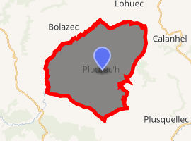
| |
 Plourac'h  Plourac'h | |
| Coordinates: 48°25′01″N 3°32′45″W | |
| Country | France |
| Region | Brittany |
| Department | Côtes-d'Armor |
| Arrondissement | Guingamp |
| Canton | Callac |
| Intercommunality | Callac-Argoat |
| Government | |
| • Mayor (2014–2020) | Yannick Larvor |
| Area 1 | 32.15 km2 (12.41 sq mi) |
| Population (2017-01-01)[1] | 319 |
| • Density | 9.9/km2 (26/sq mi) |
| Time zone | UTC+01:00 (CET) |
| • Summer (DST) | UTC+02:00 (CEST) |
| INSEE/Postal code | 22231 /22160 |
| Elevation | 125–284 m (410–932 ft) |
| 1 French Land Register data, which excludes lakes, ponds, glaciers > 1 km2 (0.386 sq mi or 247 acres) and river estuaries. | |
Population
| Year | Pop. | ±% |
|---|---|---|
| 1793 | 1,015 | — |
| 1806 | 932 | −8.2% |
| 1821 | 1,013 | +8.7% |
| 1831 | 1,265 | +24.9% |
| 1836 | 1,158 | −8.5% |
| 1841 | 1,240 | +7.1% |
| 1846 | 1,242 | +0.2% |
| 1851 | 1,320 | +6.3% |
| 1856 | 1,312 | −0.6% |
| 1861 | 1,368 | +4.3% |
| 1866 | 1,398 | +2.2% |
| 1872 | 1,454 | +4.0% |
| 1876 | 1,525 | +4.9% |
| 1881 | 1,481 | −2.9% |
| 1886 | 1,547 | +4.5% |
| 1891 | 1,537 | −0.6% |
| 1896 | 1,593 | +3.6% |
| 1901 | 1,528 | −4.1% |
| 1906 | 1,568 | +2.6% |
| 1911 | 1,612 | +2.8% |
| 1921 | 1,488 | −7.7% |
| 1926 | 1,388 | −6.7% |
| 1931 | 1,338 | −3.6% |
| 1936 | 1,259 | −5.9% |
| 1946 | 1,153 | −8.4% |
| 1954 | 960 | −16.7% |
| 1962 | 836 | −12.9% |
| 1968 | 742 | −11.2% |
| 1975 | 592 | −20.2% |
| 1982 | 513 | −13.3% |
| 1990 | 437 | −14.8% |
| 1999 | 370 | −15.3% |
| 2008 | 350 | −5.4% |
Inhabitants of Plourac'h are called plouracois in French.
gollark: Well, because I inconsistently jump around between various things, and use tabs as markers of "look at this at some point".
gollark: Big difference.
gollark: I don't have *100*, I have *310ish*.
gollark: But they *do* run in the background, to some extent.
gollark: I have an addon called "tab suspender" which lets me manually unload tabs to save RAM and let me have hundreds without problems.
See also
- Communes of the Côtes-d'Armor department
- List of works of the two Folgoët ateliers
- Listing of the works of the Maître de Laz
External links
| Wikimedia Commons has media related to Plourac'h. |
- Official website (in French)
- French Ministry of Culture list for Plourac'h (in French)
| Authority control |
|
|---|
This article is issued from Wikipedia. The text is licensed under Creative Commons - Attribution - Sharealike. Additional terms may apply for the media files.