Pine Mountain (Bartow County, Georgia)
Pine Mountain is a summit in Cartersville, Georgia.[3] At its highest point, the mountain has an elevation of 1,562 feet (476 m).[1] Pine Mountain contains several miles worth of hiking trails.
| Pine Mountain | |
|---|---|
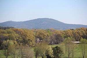
 Pine Mountain, viewed from the Etowah Indian Mounds | |
| Highest point | |
| Elevation | 1,562 ft (476 m) [1] |
| Prominence | 582 ft (177 m) [1] |
| Coordinates | 34°10′35″N 84°44′43″W [2] |
| Geography | |
| Location | Cartersville, Bartow County, Georgia, U.S. |
| Parent range | Appalachian Mountains |
| Topo map | USGS Allatoona Dam[2] |
| Climbing | |
| Easiest route | Hike |
Geography
Pine Mountain is located in southeastern Bartow County.[2] I-75 runs to the west of the mountain, while Lake Allatoona is located to the east.[4] The summit, located inside Cartersville's city limits, is mostly treeless and contains several rock outcrops.[4][5] Lake Allatoona, Cartersville, Plant Bowen and Atlanta are visible from the summit.[5][6] With an elevation of 1,562 feet (476 m), Pine Mountain is the third tallest mountain of Bartow County, if using a 100 feet (30 m) prominence rule.[7] Much of land around the mountain used to be owned by businessman and politician Mark Anthony Cooper.[8]
Hiking
There are two trails that ascend the mountain: the East Loop and the West Loop trails. The East Loop can be accessed from State Route 20 spur, while the West Loop trailhead is located near I-75 Exit 288. The East and West Loops are part of the Pine Mountain Recreational Area trail system and are connected to trails that lead to Cooper's Furnace near Allatoona Dam.[9] The two trails rise over 600 feet over a course of a mile and contain several switchbacks.[5][6]
References
- "Pine Mountain". Peakbagger.com. Retrieved 2017-04-05.
- United States Geological Survey (April 4, 2017). Allatoona Dam, GA quadrangle (Topographic map). Reston, VA: United States Geological Survey. Retrieved April 4, 2017 – via TopoQuest.
- Feature Detail Report for: Pine Mountain. USGS.gov. Retrieved 5 April 2017.
- Official Map. City of Cartersville. 30 June 2015. Retrieved 3 April 2017.
- Pine Mountain Trail: double loop hike to stunning Allatoona Lake views. Retrieved 6 April 2017.
- Pine Mountain Double Loop. Retrieved 6 April 2017.
- Bartow County GA Peaks. listsofjohn.com. Retrieved 5 April 2017.
- Pine Mountain Recreation Area. City of Cartersville. 5 April 2017. Retrieved 5 April 2017.
- Pine Mountain Trail System. City of Cartersville. Retrieved 5 April 2017.
External links
| Wikimedia Commons has media related to Pine Mountain (Bartow County, Georgia). |