Pindar River
The Pindar River is a river located in Uttarakhand, India. Pindar originates from Pindari Glacier which is located in Bageshwar district of Kumaon region in Uttarakhand.[1] The source of this river, the Pindar glacier is located at an altitude of 3,820 m (12,530 ft). Pindar glacier has relatively easier access and has been documented well for its retreat over 100 years.[2] Pindar river mouth is located at Karnaprayag where it ends by its confluence with Alaknanda River.
| Pindar | |
|---|---|
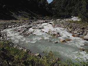 Pindar river during month of September 2011 | |
 Pinder River in far right | |
| Location | |
| Country | India |
| State | Uttarakhand |
| Region | Kumaon division |
| District | Bageshwar, Chamoli |
| Physical characteristics | |
| Source | Pindari Glacier |
| • coordinates | 30°17′N 80°01′E |
| • elevation | 3,820 m (12,530 ft) |
| Mouth | Alaknanda |
• location | Karnaprayag, Uttarakhand |
• coordinates | 30°15′49″N 79°13′00″E |
• elevation | 1,450 m (4,760 ft) |
| Length | 105 km (65 mi) |
| Basin features | |
| Tributaries | |
| • right | Kali Ganga |
Gallery
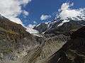 Origin from Pindari Glacier
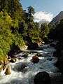 Pindari river from Dwali
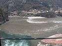 Confluence of Alaknanda and Pindar from bottom
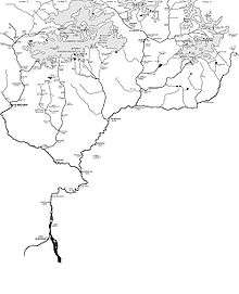
- Pinder River (far right) in the map showing The Himalayan headwaters of the Ganges river in Uttarakhand
gollark: Hmm, so we just need to nonrandomly ping 8 more people?
gollark: How many VOŦE§ did we OBTAIN?
gollark: Really? GøøÐ.
gollark: <@319753218592866315> vote gibson.
gollark: ||spoiler: snape kills trinity with rosebud||
References
- "Pindar river in Uttarakhand". Retrieved 5 July 2019.
- "Pindari Glacier". Retrieved 5 July 2019.
This article is issued from Wikipedia. The text is licensed under Creative Commons - Attribution - Sharealike. Additional terms may apply for the media files.