Pierce, Colorado
Pierce is a Statutory Town in Weld County, Colorado, United States. The population was 834 at the 2010 census. The town is a rural agricultural community located on the Colorado Eastern Plains along U.S. Highway 85 north of Greeley.
Town of Pierce, Colorado | |
|---|---|
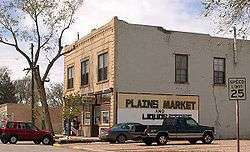 Grocery store on Main Street in Pierce, Colorado | |
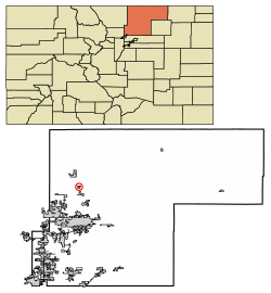 Location of Pierce in Weld County, Colorado. | |
| Coordinates: 40°38′6″N 104°45′16″W | |
| Country | |
| State | |
| County[1] | Weld |
| Founded | 1869 |
| Incorporated (town) | August 30, 1918[2] |
| Government | |
| • Type | Statutory Town[1] |
| • Mayor | M S Spurgeon-Paris |
| Area | |
| • Total | 1.86 sq mi (4.81 km2) |
| • Land | 1.86 sq mi (4.81 km2) |
| • Water | 0.00 sq mi (0.00 km2) 0.0% |
| Elevation | 5,033 ft (1,534 m) |
| Population (2010) | |
| • Total | 834 |
| • Estimate (2019)[5] | 1,133 |
| • Density | 609.80/sq mi (235.47/km2) |
| Time zone | UTC-7 (MST) |
| • Summer (DST) | UTC-6 (MDT) |
| ZIP code[6] | 80650 |
| Area code(s) | 970 |
| FIPS code | 08-59005 |
| GNIS feature ID | 0202703 |
| Website | townofpierce |
History
A post office called Pierce has been in operation since 1903.[7] The town was named after John Pierce, a railroad official.[8]
Geography
Pierce is located at 40°38′6″N 104°45′16″W (40.635134, -104.754574).[9]
According to the United States Census Bureau, the town has a total area of 0.7 square miles (1.8 km2), all of it land.

Demographics
| Historical population | |||
|---|---|---|---|
| Census | Pop. | %± | |
| 1920 | 327 | — | |
| 1930 | 281 | −14.1% | |
| 1940 | 343 | 22.1% | |
| 1950 | 372 | 8.5% | |
| 1960 | 424 | 14.0% | |
| 1970 | 452 | 6.6% | |
| 1980 | 878 | 94.2% | |
| 1990 | 823 | −6.3% | |
| 2000 | 884 | 7.4% | |
| 2010 | 834 | −5.7% | |
| Est. 2019 | 1,133 | [5] | 35.9% |
| U.S. Decennial Census[10] | |||
As of the census[11] of 2000, there were 884 people, 312 households, and 249 families residing in the town. The population density was 1,198.7 people per square mile (461.2/km2). There were 318 housing units at an average density of 431.2 per square mile (165.9/km2). The racial makeup of the town was 86.99% White, 0.45% Native American, 0.79% Asian, 0.11% Pacific Islander, 9.73% from other races, and 1.92% from two or more races. Hispanic or Latino of any race were 20.48% of the population.
There were 312 households, out of which 39.4% had children under the age of 18 living with them, 62.8% were married couples living together, 11.5% had a female householder with no husband present, and 19.9% were non-families. 17.0% of all households were made up of individuals, and 4.8% had someone living alone who was 65 years of age or older. The average household size was 2.83 and the average family size was 3.15.
In the town, the population was spread out, with 30.4% under the age of 18, 7.7% from 18 to 24, 31.9% from 25 to 44, 19.0% from 45 to 64, and 11.0% who were 65 years of age or older. The median age was 35 years. For every 100 females, there were 102.3 males. For every 100 females age 18 and over, there were 99.7 males.
The median income for a household in the town was $36,944, and the median income for a family was $44,265. Males had a median income of $33,611 versus $22,174 for females. The per capita income for the town was $17,412. About 4.6% of families and 6.9% of the population were below the poverty line, including 9.0% of those under age 18 and 10.4% of those age 65 or over.
In popular culture
The opening scene of the 2000 science fiction film Titan A.E. takes place in Pierce, Colorado in the year 3028, right before Earth is destroyed by aliens. It is seen to have a futuristic spaceport.
See also
- Outline of Colorado
- State of Colorado
- Colorado cities and towns
- Colorado municipalities
- Colorado counties
- Colorado metropolitan areas
- Front Range Urban Corridor
- North Central Colorado Urban Area
- Denver-Aurora-Boulder, CO Combined Statistical Area
- Greeley, CO Metropolitan Statistical Area
- Colorado cities and towns
References
- "Active Colorado Municipalities". State of Colorado, Department of Local Affairs. Archived from the original on 2009-12-12. Retrieved 2007-09-01.
- "Colorado Municipal Incorporations". State of Colorado, Department of Personnel & Administration, Colorado State Archives. 2004-12-01. Retrieved 2007-09-02.
- "2019 U.S. Gazetteer Files". United States Census Bureau. Retrieved July 1, 2020.
- "US Board on Geographic Names". United States Geological Survey. 2007-10-25. Retrieved 2008-01-31.
- "Population and Housing Unit Estimates". United States Census Bureau. May 24, 2020. Retrieved May 27, 2020.
- "ZIP Code Lookup" (JavaScript/HTML). United States Postal Service. Retrieved December 14, 2007.
- "Post offices". Jim Forte Postal History. Retrieved 7 July 2016.
- Dawson, John Frank. Place names in Colorado: why 700 communities were so named, 150 of Spanish or Indian origin. Denver, CO: The J. Frank Dawson Publishing Co. p. 41.
- "US Gazetteer files: 2010, 2000, and 1990". United States Census Bureau. 2011-02-12. Retrieved 2011-04-23.
- "Census of Population and Housing". Census.gov. Retrieved June 4, 2015.
- "U.S. Census website". United States Census Bureau. Retrieved 2008-01-31.
External links
Municipalities and communities of Weld County, Colorado, United States | ||
|---|---|---|
| Cities | 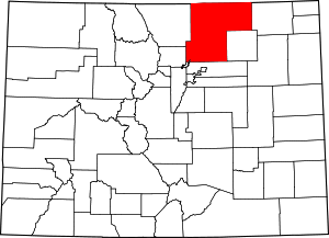 Map of Colorado highlighting Weld County | |
| Towns | ||
| CDP | ||
| Unincorporated communities | ||
| Ghost towns | ||
| Footnotes | ‡This populated place also has portions in an adjacent county or counties | |