Penumaka
Penumaka is a neighbourhood of Amaravati, the state capital of the Indian state of Andhra Pradesh.[2][5] It was a village in Tadepalle mandal of Guntur district, prior to its de–notification as gram panchayat.[3]
Penumaka | |
|---|---|
Village | |
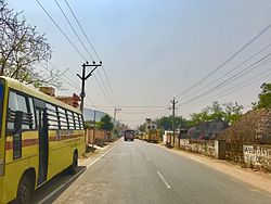 Penumaka main road | |
.svg.png) Penumaka Location in Andhra Pradesh, India | |
| Coordinates: 16.4832°N 80.5749°E | |
| Country | India |
| State | Andhra Pradesh |
| District | Guntur |
| Mandal | Tadepalle |
| Government | |
| • Type | Panchayati raj |
| • Body | Penumaka gram panchayat |
| Area | |
| • Total | 884 ha (2,184 acres) |
| Population | |
| • Total | 7,918 |
| • Density | 900/km2 (2,300/sq mi) |
| Languages | |
| • Official | Telugu |
| Time zone | UTC+5:30 (IST) |
| PIN | 522xxx |
| Area code(s) | +91–8640 |
| Vehicle registration | AP |
Demographics
At the 2011 Census of India, the town had a population of 7,918 (3,997 males and 3,921 females). The population under 6 years of age was 790. The average literacy rate was 71.11%.[3]
Government and politics
Penumaka gram panchayat is the local self-government of the village.[1] It is divided into wards and each ward is represented by a ward member.[6] The ward members are headed by a Sarpanch.[7] The village forms a part of capital city, Andhra Pradesh Capital Region and is under the jurisdiction of APCRDA.[2]
Transport
Penumaka is located on the Vijayawada-Amaravati road.[8] APSRTC operates buses on this route from Pandit Nehru bus station in Vijayawada.[9]
See also
References
- "Gram Panchayat Identification Codes" (PDF). Saakshar Bharat Mission. National Informatics Centre. p. 120. Archived from the original (PDF) on 18 August 2017. Retrieved 7 May 2019.
- "Declaration of A.P. Capital City Area–Revised orders" (PDF). APCRDA. Municipal Administration & Urban Development Department-Andhra Pradesh. 9 June 2015. p. 3. Archived from the original (PDF) on 24 June 2016. Retrieved 7 May 2019.
- "District Census Hand Book – Guntur" (PDF). Census of India. Registrar General and Census Commissioner of India. pp. 14, 264. Retrieved 7 May 2019.
- "Population". Census of India. Registrar General and Census Commissioner of India. Retrieved 8 May 2019.
- "New Andhra capital Amaravati to compete for Smart City tag". The New Indian Express. 25 May 2016. Retrieved 6 June 2016.
- Seetharam, Mukkavilli (1 January 1990). Citizen Participation in Rural Development. Mittal Publications. p. 34. ISBN 9788170992271.
- Social Science. Vk Publications. p. 117. ISBN 9788179732144.
- "Four-lane road to Andhra Pradesh new capital soon". The Hindu. Guntur. 6 August 2015. Retrieved 4 June 2016.
- "RTC to introduce bus services in Guntur city".