Pendleton, Missouri
Pendleton is an incorporated village[4] in Warren County, Missouri, United States. The population was 43 at the 2010 census.
Pendleton, Missouri | |
|---|---|
| Area | |
| • Total | 0.33 sq mi (0.85 km2) |
| • Land | 0.33 sq mi (0.85 km2) |
| • Water | 0.00 sq mi (0.00 km2) |
| Population | |
| • Total | 43 |
| • Estimate (2019)[3] | 46 |
| • Density | 140.24/sq mi (54.13/km2) |
| FIPS code | 29-56882 |
History
A post office called Pendleton was established in 1833, and remained in operation until 1951.[5] J. W. Pendleton, an early postmaster, most likely gave the community his last name.[6] Pendleton was platted in 1858 when the railroad was extended to that point.[6]
Geography
According to the United States Census Bureau, the village has a total area of 0.09 square miles (0.23 km2), all land.[7]
Demographics
| Historical population | |||
|---|---|---|---|
| Census | Pop. | %± | |
| 2010 | 43 | — | |
| Est. 2019 | 46 | [3] | 7.0% |
| U.S. Decennial Census[8] | |||
2010 census
As of the census[2] of 2010, there were 43 people, 14 households, and 11 families residing in the village. The population density was 477.8 inhabitants per square mile (184.5/km2). There were 15 housing units at an average density of 166.7 per square mile (64.4/km2). The racial makeup of the village was 100.0% White.
There were 14 households of which 42.9% had children under the age of 18 living with them, 42.9% were married couples living together, 28.6% had a female householder with no husband present, 7.1% had a male householder with no wife present, and 21.4% were non-families. 21.4% of all households were made up of individuals. The average household size was 3.07 and the average family size was 3.64.
The median age in the village was 33.5 years. 30.2% of residents were under the age of 18; 9.4% were between the ages of 18 and 24; 21% were from 25 to 44; 35% were from 45 to 64; and 4.7% were 65 years of age or older. The gender makeup of the village was 48.8% male and 51.2% female.
References
- "2019 U.S. Gazetteer Files". United States Census Bureau. Retrieved July 26, 2020.
- "U.S. Census website". United States Census Bureau. Retrieved 2012-07-08.
- "Population and Housing Unit Estimates". United States Census Bureau. May 24, 2020. Retrieved May 27, 2020.
- "Boundary Changes". Geographic Change Notes: Missouri. Population Division, United States Census Bureau. 2006-05-19. Archived from the original on 2006-02-06. Retrieved 2008-07-13.
- "Post Offices". Jim Forte Postal History. Retrieved 30 December 2016.
- "Warren County Place Names, 1928–1945". The State Historical Society of Missouri. Archived from the original on June 24, 2016. Retrieved December 30, 2016.
- "US Gazetteer files 2010". United States Census Bureau. Archived from the original on 2012-01-24. Retrieved 2012-07-08.
- "Census of Population and Housing". Census.gov. Retrieved June 4, 2015.
Municipalities and communities of Warren County, Missouri, United States | ||
|---|---|---|
| Cities | 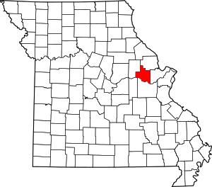 Map of Missouri highlighting Warren County | |
| Villages | ||
| Townships |
| |
| Unincorporated communities | ||
| Ghost towns | ||
| Footnotes | ‡This populated place also has portions in an adjacent county or counties | |