Peachland, North Carolina
Peachland is a town in Anson County, North Carolina, United States. The population was 437 at the 2010 census.[5]
Peachland, North Carolina | |
|---|---|
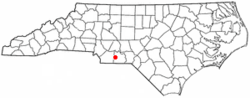 Location of Peachland, North Carolina | |
| Coordinates: 34°59′34″N 80°15′53″W | |
| Country | United States |
| State | North Carolina |
| County | Anson |
| Area | |
| • Total | 1.01 sq mi (2.61 km2) |
| • Land | 1.01 sq mi (2.61 km2) |
| • Water | 0.00 sq mi (0.00 km2) |
| Elevation | 449 ft (137 m) |
| Population (2010) | |
| • Total | 437 |
| • Estimate (2019)[2] | 402 |
| • Density | 398.81/sq mi (153.99/km2) |
| Time zone | UTC-5 (Eastern (EST)) |
| • Summer (DST) | UTC-4 (EDT) |
| ZIP code | 28133 |
| Area code(s) | 704 |
| FIPS code | 37-50820[3] |
| GNIS feature ID | 0991978[4] |
| Website | www |
History
The Barrett-Faulkner House was listed on the National Register of Historic Places in 2012.[6]
Geography
Peachland is located at 34°59′34″N 80°15′53″W (34.992687, -80.264754).[7]
According to the United States Census Bureau, the town has a total area of 1.0 square mile (2.6 km2), all of it land.
Peachland is located on U.S. Route 74, a four-lane divided highway that enters the city limits, but bypasses Peachland's business district. Since US 74 does not pass through any business or residential areas, its speed limit is 55 miles per hour (89 km/h) even within the city limits.
Demographics
| Historical population | |||
|---|---|---|---|
| Census | Pop. | %± | |
| 1890 | 58 | — | |
| 1900 | 156 | 169.0% | |
| 1910 | 232 | 48.7% | |
| 1920 | 196 | −15.5% | |
| 1930 | 203 | 3.6% | |
| 1940 | 390 | 92.1% | |
| 1950 | 485 | 24.4% | |
| 1960 | 563 | 16.1% | |
| 1970 | 556 | −1.2% | |
| 1980 | 506 | −9.0% | |
| 1990 | 384 | −24.1% | |
| 2000 | 554 | 44.3% | |
| 2010 | 437 | −21.1% | |
| Est. 2019 | 402 | [2] | −8.0% |
| U.S. Decennial Census[8] | |||
As of the census[3] of 2000, there were 554 people, 198 households, and 152 families residing in the town. The population density was 561.4 people per square mile (216.1/km2). There were 213 housing units at an average density of 215.8 per square mile (83.1/km2). The racial makeup of the town was 65.88% White, 31.23% African American, 0.54% Native American, 0.18% Pacific Islander, 0.54% from other races, and 1.62% from two or more races. Hispanic or Latino of any race were 1.99% of the population.
There were 198 households, out of which 33.3% had children under the age of 18 living with them, 51.0% were married couples living together, 19.7% had a female householder with no husband present, and 23.2% were non-families. 22.7% of all households were made up of individuals, and 11.1% had someone living alone who was 65 years of age or older. The average household size was 2.80 and the average family size was 3.26.
In the town, the population was spread out, with 28.2% under the age of 18, 8.7% from 18 to 24, 27.6% from 25 to 44, 20.2% from 45 to 64, and 15.3% who were 65 years of age or older. The median age was 34 years. For every 100 females, there were 87.8 males. For every 100 females age 18 and over, there were 93.2 males.
The median income for a household in the town was $28,250, and the median income for a family was $31,923. Males had a median income of $29,773 versus $21,346 for females. The per capita income for the town was $12,607. About 20.7% of families and 26.5% of the population were below the poverty line, including 38.3% of those under age 18 and 11.6% of those age 65 or over.
References
- "2019 U.S. Gazetteer Files". United States Census Bureau. Retrieved July 27, 2020.
- "Population and Housing Unit Estimates". United States Census Bureau. May 24, 2020. Retrieved May 27, 2020.
- "U.S. Census website". United States Census Bureau. Retrieved 2008-01-31.
- "US Board on Geographic Names". United States Geological Survey. 2007-10-25. Retrieved 2008-01-31.
- "Geographic Identifiers: 2010 Demographic Profile Data (G001): Peachland town, North Carolina". U.S. Census Bureau, American Factfinder. Retrieved July 3, 2013.
- "National Register of Historic Places Listings". Weekly List of Actions Taken on Properties: 9/04/12 through 9/07/12. National Park Service. 2012-09-14.
- "US Gazetteer files: 2010, 2000, and 1990". United States Census Bureau. 2011-02-12. Retrieved 2011-04-23.
- "Census of Population and Housing". Census.gov. Retrieved June 4, 2015.
External links
Municipalities and communities of Anson County, North Carolina, United States | ||
|---|---|---|
| Towns |  | |
| Unincorporated community | ||
| Ghost town | ||
| Authority control |
|
|---|