Pawnee Rock, Kansas
Pawnee Rock is a city in Barton County, Kansas, United States. As of the 2010 census, the city population was 252.[6]
Pawnee Rock, Kansas | |
|---|---|
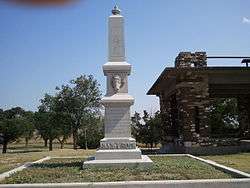 Pawnee Rock Monument near Pawnee Rock (2013) | |
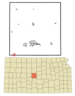 Location within Barton County and Kansas | |
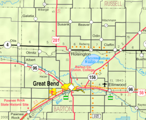 KDOT map of Barton County (legend) | |
| Coordinates: 38°15′55″N 98°58′57″W | |
| Country | United States |
| State | Kansas |
| County | Barton |
| Founded | 1874 |
| Incorporated | 1887 |
| Named for | Pawnee Rock |
| Area | |
| • Total | 0.28 sq mi (0.73 km2) |
| • Land | 0.28 sq mi (0.73 km2) |
| • Water | 0.00 sq mi (0.00 km2) |
| Elevation | 1,949 ft (594 m) |
| Population | |
| • Total | 252 |
| • Estimate (2019)[3] | 231 |
| • Density | 819.15/sq mi (316.40/km2) |
| Time zone | UTC-6 (CST) |
| • Summer (DST) | UTC-5 (CDT) |
| ZIP code | 67567 |
| Area code | 620 |
| FIPS code | 20-54875 [4] |
| GNIS ID | 0484937 [5] |
| Website | pawneerock-ks.gov |
History
Pawnee Rock was founded in 1874.[7] It was named from the historic landmark Pawnee Rock nearby.[8] Pawnee Rock was incorporated in 1887.[9]
Pawnee Rock State Historic Site
One-half mile north of U.S. 56 and the town of Pawnee Rock is Pawnee Rock State Historic Site, a monument to travellers on the Santa Fe trail. It marks the approximate halfway point on the Santa Fe Trail. The monument consists of a rough stone pole building used for picnics and a granite pillar shaped monument atop a small hill.[10]
Geography
Pawnee Rock is located at 38°15′55″N 98°58′57″W (38.265283, -98.982614).[11] According to the United States Census Bureau, the city has a total area of 0.28 square miles (0.73 km2), all of it land.[12]
While located in Barton Country, the south edge of Pawnee Rock lies along the Barton / Pawnee county line.
Demographics
| Historical population | |||
|---|---|---|---|
| Census | Pop. | %± | |
| 1880 | 84 | — | |
| 1890 | 204 | 142.9% | |
| 1900 | 210 | 2.9% | |
| 1910 | 458 | 118.1% | |
| 1920 | 428 | −6.6% | |
| 1930 | 399 | −6.8% | |
| 1940 | 388 | −2.8% | |
| 1950 | 359 | −7.5% | |
| 1960 | 380 | 5.8% | |
| 1970 | 442 | 16.3% | |
| 1980 | 409 | −7.5% | |
| 1990 | 367 | −10.3% | |
| 2000 | 356 | −3.0% | |
| 2010 | 252 | −29.2% | |
| Est. 2019 | 231 | [3] | −8.3% |
| U.S. Decennial Census | |||
2010 census
As of the census[2] of 2010, there were 252 people, 107 households, and 71 families living in the city. The population density was 900.0 inhabitants per square mile (347.5/km2). There were 137 housing units at an average density of 489.3 per square mile (188.9/km2). The racial makeup of the city was 96.0% White, 0.4% Native American, 0.4% from other races, and 3.2% from two or more races. Hispanic or Latino of any race were 2.4% of the population.
There were 107 households of which 30.8% had children under the age of 18 living with them, 46.7% were married couples living together, 14.0% had a female householder with no husband present, 5.6% had a male householder with no wife present, and 33.6% were non-families. 29.0% of all households were made up of individuals and 9.3% had someone living alone who was 65 years of age or older. The average household size was 2.36 and the average family size was 2.93.
The median age in the city was 44.2 years. 25.4% of residents were under the age of 18; 5.1% were between the ages of 18 and 24; 21.2% were from 25 to 44; 37.3% were from 45 to 64; and 11.1% were 65 years of age or older. The gender makeup of the city was 54.4% male and 45.6% female.
2000 census
As of the census[4] of 2000, there were 356 people, 131 households, and 88 families living in the city. The population density was 1,294.0 people per square mile (490.9/km2). There were 158 housing units at an average density of 574.3 per square mile (217.9/km2). The racial makeup of the city was 97.19% White, 0.28% African American, 0.84% Native American, 0.84% from other races, and 0.84% from two or more races. Hispanic or Latino of any race were 2.53% of the population.
There were 131 households out of which 38.2% had children under the age of 18 living with them, 46.6% were married couples living together, 15.3% had a female householder with no husband present, and 32.1% were non-families. 26.0% of all households were made up of individuals and 9.2% had someone living alone who was 65 years of age or older. The average household size was 2.72 and the average family size was 3.30.
In the city, the population was spread out with 36.2% under the age of 18, 6.7% from 18 to 24, 28.1% from 25 to 44, 19.9% from 45 to 64, and 9.0% who were 65 years of age or older. The median age was 32 years. For every 100 females, there were 92.4 males. For every 100 females age 18 and over, there were 89.2 males.
The median income for a household in the city was $38,393, and the median income for a family was $39,375. Males had a median income of $25,625 versus $19,821 for females. The per capita income for the city was $12,651. About 10.6% of families and 9.6% of the population were below the poverty line, including 7.7% of those under age 18 and 7.1% of those age 65 or over.
Education
Pawnee Rock is a part of USD 495 Ft. Larned.[13]
Pawnee Rock schools were closed through school unification. The Pawnee Rock High School mascot was Pawnee Rock Braves.[14]
See also
References
- "2019 U.S. Gazetteer Files". United States Census Bureau. Retrieved July 24, 2020.
- "U.S. Census website". United States Census Bureau. Retrieved 2012-07-06.
- "Population and Housing Unit Estimates". United States Census Bureau. May 24, 2020. Retrieved May 27, 2020.
- "U.S. Census website". United States Census Bureau. Retrieved 2008-01-31.
- "US Board on Geographic Names". United States Geological Survey. 2007-10-25. Retrieved 2008-01-31.
- "2010 City Population and Housing Occupancy Status". U.S. Census Bureau. Retrieved September 21, 2011.
- Blackmar, Frank Wilson (1912). Kansas: A Cyclopedia of State History, Volume 2. Standard Publishing Company. pp. 457.
- Kansas State Historical Society (1916). Biennial Report of the Board of Directors of the Kansas State Historical Society. Kansas State Printing Plant. pp. 146.
- Biographical History of Barton County, Kansas. Great Bend Tribune. 1912. pp. 145.
- Kansas State Historical Society -- Pawnee Rock State Historical Site
- "US Gazetteer files: 2010, 2000, and 1990". United States Census Bureau. 2011-02-12. Retrieved 2011-04-23.
- "US Gazetteer files 2010". United States Census Bureau. Archived from the original on January 12, 2012. Retrieved 2012-07-06.
- "Ft Larned Unified School District". USD 495. Archived from the original on 25 September 2016. Retrieved 5 January 2017.
- "Western Kansas Basketball Results", Great Bend Tribune, 13 December 1967, p.5.
Further reading
External links
- City
- Schools
- USD 495, local school district
- Maps
- Pawnee Rock City Map, KDOT
Municipalities and communities of Barton County, Kansas, United States | ||
|---|---|---|
| Cities |  Map of Kansas highlighting Barton County | |
| CDPs | ||
| Unincorporated communities | ||
| Townships | ||
| Footnotes | ‡This populated place also has portions in an adjacent county or counties | |