Paul Avenue station
Paul Avenue was a Caltrain station located in the Bayview neighborhood of San Francisco, California. The lightly-used station was closed on August 1, 2005, and the platform and shelter were removed in 2009. A replacement station to the north has been proposed.
Paul Avenue | |||||||||||||||||||||||||
|---|---|---|---|---|---|---|---|---|---|---|---|---|---|---|---|---|---|---|---|---|---|---|---|---|---|
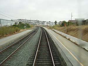
 Paul Avenue station in July 2005 | |||||||||||||||||||||||||
| Location | 1 Gould Street San Francisco, California[1] | ||||||||||||||||||||||||
| Coordinates | 37°43′24″N 122°23′49″W | ||||||||||||||||||||||||
| Owned by | Peninsula Corridor Joint Powers Board | ||||||||||||||||||||||||
| Line(s) | Peninsula Subdivision[2] | ||||||||||||||||||||||||
| Platforms | 2 side platforms (now demolished) | ||||||||||||||||||||||||
| Other information | |||||||||||||||||||||||||
| Fare zone | Fare Zone 1 | ||||||||||||||||||||||||
| History | |||||||||||||||||||||||||
| Closed | August 1, 2005 | ||||||||||||||||||||||||
| Original company | Southern Pacific | ||||||||||||||||||||||||
| Traffic | |||||||||||||||||||||||||
| Passengers (2005[3]) | 1 (daily average) | ||||||||||||||||||||||||
| Former services | |||||||||||||||||||||||||
| |||||||||||||||||||||||||
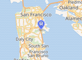
| Location | |||||||||||||||||||||||||

| |||||||||||||||||||||||||
History
Soon after Caltrans took over operation of the Peninsula Commute service, a study was published in 1982 recommending that Paul Avenue be closed.[4] Service was reduced after the 1982 study.[5]:27–28 A 1987 ridership survey showed that on a typical weekday, 37 northbound passengers disembarked at Paul, 1 northbound passenger embarked, and 43 southbound passengers disembarked.[5]:15 In the late 1990s, Caltrain staff recommended that the station be closed due to low ridership – it was located away from residential and commercial areas, and riders found it unsafe.[6][7] It was to require $3.65 million to stabilize a crumbling embankment, and modernizing the station was to have cost significantly more. However, the Caltrain board voted in February 1999 to keep the station open due to pressure from the neighborhood and from mayor Willie Brown.[7]
After the Caltrain Express project was completed in 2004, only four weekday trains stopped at Paul Avenue: one northbound and one southbound local in the early morning, and one northbound and one southbound local in the evening.[8] Before its closure in 2005, service remained at four weekday local trains, and no service on weekends.[9]
The Peninsula Corridor Joint Powers Board, the governing body of Caltrain, voted in April 2005 to suspend service to Paul Avenue effective August 1, 2005.[10][11] Weekday service was also suspended at Broadway and Atherton in order to add twelve more Baby Bullet trains to help close a funding gap, because the limited-stop express trains had typically operated at capacity and generated higher revenues than locals since their introduction in 2004.[10][11][12]
The abandoned station was soon covered with trash and graffiti. Caltrain cleaned up the larger debris in March 2009. That July, the platforms and shelter were removed, the graffiti painted over, and a fence installed to deter access.[13][14]
Oakdale station proposal
When Caltrain was still being operated by Caltrans, a report was published in 1988 from a study to evaluate the feasibility of replacing Paul Avenue with a new station to the north at either Williams Avenue, Palou Avenue, or Evans Avenue. The report was prepared in conjunction with the effort to create a home port for USS Missouri (BB-63) in San Francisco at the Hunters Point Shipyard, and concluded that with the completion of the Downtown Rail Extension, daily ridership could increase to 2,400. However, without the Downtown Extension, ridership would be limited to less than 100. The preferred site was at Evans Avenue.[5]
The Bayview Hunters Point Community Revitalization Concept Plan (March 2002) identified the Oakdale-Palou area as the community's preferred location for the Caltrain station.[15] A 2005 feasibility study proposed a new station just north of Oakdale Avenue (37.738°N 122.3948°W) next to the City College of San Francisco Southeast Campus in Bayview, 1.0 mile (1.6 km) north of the former Paul Avenue station. The new station would have platforms passing over Quint, and bus stops for four lines would be located within walking distance of the new station.[16]:18 Just north of Oakdale, freight trains are routed east along the Quint Street Lead, which branches from the main line, to the Intermodal Freight Rail Cargo Transfer Facility near Piers 90–96.[16]:27 A follow-up study in 2014 predicted daily ridership of around 2,350.[6][17] In the vicinity of the proposed station, the Caltrain line is grade-separated from Oakdale (which passes over the rail line) and Quint. Prior to 2016, the rail line was carried over Quint on a steel bridge originally constructed for the Bayshore Cutoff in the early 1900s. In preparation for a new Oakdale station, the bridge, which was structurally deficient, was removed on April 30 and replaced by a berm completed in July 2016, which severed Quint between Oakdale and Jerrold.[18] A new road has been proposed on land belonging to Union Pacific west of the tracks, to reconnect Quint to Jerrold.[19]
References
- "Caltrain Stations". Peninsula Corridor Joint Powers Board. 2002. Archived from the original on August 22, 2005.
- SMA Rail Consulting (April 2016). "California Passenger Rail Network Schematics" (PDF). California Department of Transportation. p. 13.
- "Caltrain Weekday Station Passenger Boardings – 1992 & 1995 through 2007". Peninsula Corridor Joint Powers Board. Archived from the original on October 7, 2007.
- Barton-Aschman Associates (198). Caltrans commuter rail station location and improvement study (Report). California Department of Transportation.
- Evaluation of the Feasibility of Constructing a Peninsula Commute Service (CalTrain) Station in the South Bayshore/Hunters Point Area of San Francisco and of Closing the Paul Street Station (PDF) (Report). California Department of Transportation, District 4: Public Transportation Branch. Fall 1988.
- "Fact Sheet: Caltrain Station at Oakdale Avenue" (PDF). San Francisco County Transportation Authority. March 2014.
- Hendricks, Tyche (February 5, 1999). "Caltrain board to keep Paul Avenue station open". San Francisco Chronicle.
- "Timetable" (PDF). Peninsula Corridor Joint Powers Board. June 5, 2004. Archived from the original (PDF) on June 9, 2004. Retrieved June 4, 2018.
- "Timetable" (PDF). Peninsula Corridor Joint Powers Board. May 2, 2005. Archived from the original (PDF) on May 24, 2005.
- "Caltrain OK's Fare Increase, Service Revamp to Close Deficit" (Press release). Peninsula Corridor Joint Powers Board. April 25, 2005. Archived from the original on May 7, 2005. Retrieved June 4, 2018.
- "Caltrain to Continue Weekend Service for Broadway and Atherton" (Press release). Peninsula Corridor Joint Powers Board. May 23, 2005. Archived from the original on May 26, 2005. Retrieved June 4, 2018.
- "Caltrain Adding Two More Bullet Trains to Help Financial Crisis" (Press release). Peninsula Corridor Joint Powers Board. April 13, 2005. Archived from the original on May 7, 2005. Retrieved June 4, 2018.
- Curiel, Jonathan (April 2, 2009). "San Francisco: Paul Avenue Station clean up". San Francisco Examiner.
- Curiel, Jonathan (July 7, 2009). "S.F.: Paul Avenue Caltrain Station cleaned up". San Francisco Examiner.
- "4, Part II: Physical Planning and Environmental Programs". Bayview Hunters Point Community Revitalization Concept Plan (PDF) (Report). San Francisco Planning Department. pp. 108–109. Retrieved 17 October 2018.
- HNTB Corporation (February 2005). Bayview-Oakdale Caltrain Station Study (PDF) (Report). San Franicsco County Transportation Authority. Retrieved 17 October 2018.
- Caltrain Oakdale Station Ridership Study (PDF) (Report). San Francisco County Transportation Authority. March 2014. Retrieved 17 October 2018.
- "Quint Street Project". Peninsula Corridor Joint Powers Board. Retrieved 17 October 2018.
- "Quint-Jerrold Connector Road (and the Quint Street Bridge Replacement Project)". San Francisco County Transportation Authority. Retrieved 17 October 2018.
External links
| Wikimedia Commons has media related to Paul Avenue station. |
- Ehrlich, Peter (24 June 1994). "CALTRAIN--Train 45 arr Paul Avenue IB". flickr. Retrieved 4 June 2018.
- Browne, Arne (7 June 2008). "Caltrain passing abandoned Paul Avenue Station Stop". flickr. Retrieved 4 June 2018.
- SFCTA – Caltrain Oakdale Station Study
