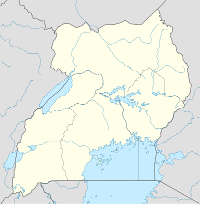
Paranga, Uganda
Paranga is a town in Gulu District, in Northern Uganda.
Paranga | |
|---|---|
 Paranga Location in Uganda | |
| Coordinates: 02°34′32″N 32°21′25″E | |
| Country | |
| Regions | Northern Uganda |
| Sub-region | Acholi sub-region |
| District | Gulu District |
| Elevation | 3,540 ft (1,080 m) |
Location
Paranga is bordered by Barogal to the north, Ongwam to the northeast, Moru to the east, Ngai to the southeast, Bobi to the south and Ongoko to the west. This location is approximately 26 kilometres (16 mi), by road, south of Gulu, where the district headquarters are located.[1] The coordinates of the town are:02 34 32N, 32 21 25E (Latitude:2.257556; Longitude:32.35695).
Landmarks
The landmarks within the town limits or close to the edges of the town include:
- The junction of the Gulu-Masindi Highway with the Gulu-Lira Highway
- The junction of the Gulu-Masindi Highway with the Bobi-Nwoya Highway, located at Bobi, approximately 4.4 kilometres (2.7 mi), south of Paranga.[2]
- The offices of Paranga Town Council
- Paranga Central Market
gollark: Putting everything in kernelspace is worse for security and maintainability.
gollark: But yes, I agree.
gollark: Context switch overhead is somewhat unavoidable.
gollark: citrons: it is highly macrokernelous.
gollark: The kernel versions don't line up with Android OS versions.
See also
- Gulu
- Gulu District
- Acholi sub-region
- Acholi people
- Northern Region, Uganda
References
Capital: Gulu | ||
| Towns and villages | 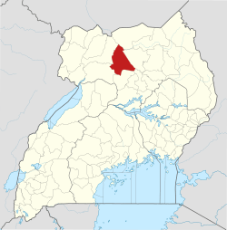 | |
| Banking | ||
| Hotels | ||
| Health |
| |
| Notable landmarks |
| |
| Transport |
| |
| Energy |
| |
| Education | ||
| Notable people | ||
This article is issued from Wikipedia. The text is licensed under Creative Commons - Attribution - Sharealike. Additional terms may apply for the media files.