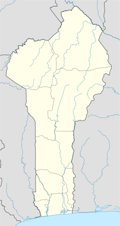
Parakou Airport
Parakou Airport (IATA: PKO, ICAO: DBBP) is a public use airport located 1 km northwest of Parakou, Borgou, Benin. It is to be replaced by the Tourou International Airport, a new airport in Tankaro, about 10 km northwest of Parakou, which will feature an asphalt runway 3,500 meters in length. The new airport entered service on 18 March 2016.[3][4]
Parakou Airport | |||||||||||
|---|---|---|---|---|---|---|---|---|---|---|---|
| Summary | |||||||||||
| Airport type | Public | ||||||||||
| Serves | Parakou | ||||||||||
| Location | |||||||||||
| Elevation AMSL | 1,289 ft / 393 m | ||||||||||
| Coordinates | 9°21′25.6″N 2°36′33.2″E | ||||||||||
| Map | |||||||||||
 DBBP Location of Parakou Airport in Benin | |||||||||||
| Runways | |||||||||||
| |||||||||||
Airlines and destinations
| Airlines | Destinations |
|---|---|
| COTAIR | Cotonou |
gollark: The energy's got to go SOMEWHERE.
gollark: A few grams of antimatter spaghetti could probably wipe out a city.
gollark: And tasty exotic particles.
gollark: Antifood will mutually annihilate with other matter and produce gamma rays.
gollark: Antispaghetti: the last cooking tool you'll ever need!
References
- Airport record for Parakou Airport at Landings.com. Retrieved 2013-08-09
- Google (2013-08-09). "location of Parakou Airport" (Map). Google Maps. Google. Retrieved 2013-08-09.
- https://beninwebtv.com/2018/05/benin-laeroport-international-de-tourou-lautre-elephant-blanc-du-regime-yayi/amp/
- http://french.china.org.cn/foreign/txt/2016-03/20/content_38067655.htm
This article is issued from Wikipedia. The text is licensed under Creative Commons - Attribution - Sharealike. Additional terms may apply for the media files.