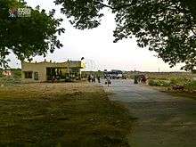
Pamur
Pamuru is a census town in Prakasam district of the Indian state of Andhra Pradesh. It is the mandal headquarters of Pamur mandal in Kandukur revenue division. This is the border town of Prakasam district. This is near from Nellore than Ongole around 100 km and also near by Kadapa.[3]
Pamuru | |
|---|---|
Census Town | |
.svg.png) Pamuru Location in Andhra Pradesh, India | |
| Coordinates: 15.1167°N 79.4167°E | |
| Country | India |
| State | Andhra Pradesh |
| District | Prakasam |
| Government | |
| • Type | Municipal corporation |
| • Body | Nagar Palika |
| Area | |
| • Total | 16.15 km2 (6.24 sq mi) |
| Population (2011)[2] | |
| • Total | 20,000 |
| • Density | 1,200/km2 (3,200/sq mi) |
| Languages | |
| • Official | Telugu |
| Time zone | UTC+5:30 (IST) |
| Vehicle registration | AP |

Demographics
As of 2011 Census of India, the town had a population of 20,000. The total population constitute, 10,340 males, 9,660 females and 2,348 children, in the age group of 0–6 years. The average literacy rate stands at 75.31% with 13,294 literates, higher than the national average of 73.00%.[4]
Education
The primary and secondary school education is imparted by government, aided and private schools, under the School Education Department of the state.[5][6] The medium of instruction followed by different schools are English, Telugu.Chief minister Nara Chandrababu Naidu laid foundation stone for the Dr APJ Abdul Kalam IIIT at Dubagunta in Pamur mandal of Kanigiri assembly constituency. IIIT will be constructed and infrastructure provided with a budget of Rs 1200 crores.
References
- "District Census Handbook - Prakasam" (PDF). Census of India. p. 16,17,48. Retrieved 18 January 2015.
- "Census 2011". The Registrar General & Census Commissioner, India. Retrieved 29 August 2014.
- "Chittoor District Mandals" (PDF). Census of India. pp. 164, 179. Retrieved 19 June 2015.
- "Chapter–3 (Literates and Literacy rate)" (PDF). Registrar General and Census Commissioner of India. Retrieved 24 August 2014.
- "School Education Department" (PDF). School Education Department, Government of Andhra Pradesh. Archived from the original (PDF) on 7 November 2016. Retrieved 7 November 2016.
- "The Department of School Education - Official AP State Government Portal | AP State Portal". www.ap.gov.in. Archived from the original on 7 November 2016. Retrieved 7 November 2016.
Harinadh