Oropeza Province
Oropeza is a province in the Chuquisaca Department, Bolivia. Its seat is Sucre which is also the constitutional capital of Bolivia and the capital of the Chuquisaca Department.
Oropeza Province | |
|---|---|
Province | |
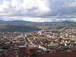
 Sucre, the constitutional capital of Bolivia and the capital of the Oropeza Province | |
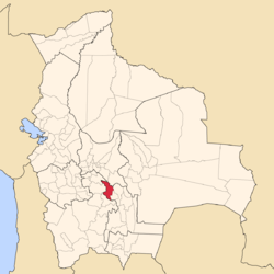
 Location of Oropeza Province within Bolivia | |
| Coordinates: 18°50′S 65°15′W | |
| Country | |
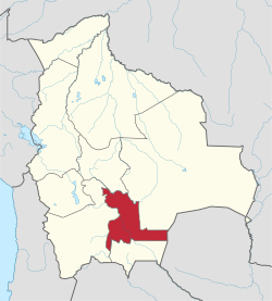
| Department | Chuquisaca Department |
| Capital | Sucre |
| Area | |
| • Total | 1,522 sq mi (3,943 km2) |
| Elevation | 7,000 ft (2,000 m) |
| Population (2001) | |
| • Total | 241,376 |
| • Density | 159/sq mi (61.2/km2) |
| • Ethnicities | Quechuas |
| Time zone | GMT -4 |
Geography
Some of the highest mountains of the province are listed below:[1][2][3][4]
- Alisu Punta
- Asna Kancha
- Chawayasqa
- Chullpa Urqu
- Chullpani
- Ch'aki Mayu
- Ch'usiqani
- Illimani
- Inti Rumi
- Jatun Pampa
- Jatun Q'asa
- Jatun Urqu
- Juch'uy Satari
- Katariri
- Kimsa Muqu
- Kimsa Ñuñu
- Kimsa T'ipa
- Misk'a Urqu
- Mulli Punta
- Mulli Urqu
- Parya Punta
- Pukara
- P'aqla Urqu
- Quchayuq
- Satari
- Tawayuq
- Tuqtu Q'asa
- Wallpa Q'asa
- Wayra Pata
- Wayrani Wayu
- Wichhu Qullu
- Wiru Wiru
Subdivision
The province is divided into three municipalities which are further subdivided into cantons.
| Section | Municipality | Inhabitants (2001) [5] | Seat | Inhabitants (2001) |
|---|---|---|---|---|
| Capital Municipality | Sucre Municipality | 214,913 | Sucre | 193,876 |
| 1st | Yotala Municipality | 9,497 | Yotala | 1,538 |
| 2nd | Poroma Municipality | 16,966 | Poroma | 486 |
The people
The people are predominantly indigenous citizens of Quechuan descent.
| Ethnic group | Sucre Municipality (%) | Yotala Municipality (%) | Poroma Municipality (%) |
|---|---|---|---|
| Quechua | 57.3 | 90.4 | 94.7 |
| Aymara | 2.3 | 0.8 | 0.9 |
| Guaraní, Chiquitos, Moxos | 1.4 | 0.2 | 0.1 |
| Not indigenous | 38.6 | 8.3 | 4.2 |
| Other indigenous groups | 0.4 | 0.3 | 0.1 |
Ref.: obd.descentralizacion.gov.bo
Languages
The languages spoken in the province are mainly Spanish and Quechua.
| Language | Sucre Municipality | Yotala Municipality | Poroma Municipality |
|---|---|---|---|
| Quechua | 116,053 | 8,197 | 15,554 |
| Aymara | 3,322 | 68 | 165 |
| Guaraní | 344 | 8 | 4 |
| Another native | 67 | 0 | 4 |
| Spanish | 183,231 | 5,587 | 4,620 |
| Foreign | 8,156 | 41 | 8 |
| Only native | 19,901 | 3,319 | 11,057 |
| Native and Spanish | 97,831 | 4,916 | 4,513 |
| Only Spanish | 85,497 | 673 | 107 |
Ref.: obd.descentralizacion.gov.bo
Places of interest

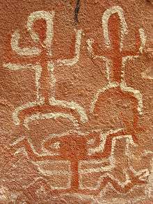
Cave paintings at Inka Mach'ay
The archaeological sites of Inka Mach'ay and Puma Mach'ay are situated within the province. Inka Mach'ay was declared a National Monument in 1958. [6]
gollark: Sometimes, perhaps?
gollark: Yes, in our bee information reactors.
gollark: I assume they're bad ones which use chemical fuel.
gollark: Nobody cares about your boring chemical guns.
gollark: *Rail*guns, kit.
See also
References
- Bolivia 1:50,000 Tasapampa 6536-III
- "Yotala". INE, Bolivia. Archived from the original on March 4, 2016. Retrieved April 14, 2016.
- Bolivian IGM map 1:50,0000 Poroma 6538-III
- "Poroma". INE, Bolivia. Archived from the original on April 15, 2016. Retrieved April 15, 2016.
- www.ine.gov.bo (Spanish)
- "Archaeological parks in Bolivia". Archived from the original on 2016-06-09. Retrieved 2010-12-21.
This article is issued from Wikipedia. The text is licensed under Creative Commons - Attribution - Sharealike. Additional terms may apply for the media files.
