Oro Bay Rural LLG
Oro Bay Rural LLG is a local-level government (LLG) of Oro Province, Papua New Guinea.[1][2]
Oro Bay Rural LLG | |
|---|---|
| Country | Papua New Guinea |
| Province | Oro Province |
| Time zone | UTC+10 (AEST) |
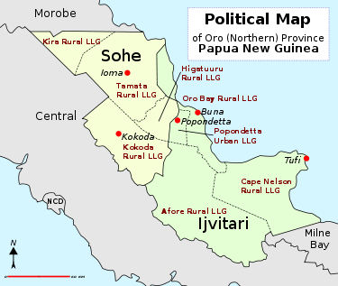
District map of Oro Province
Wards
- 01. Sariri
- 02. Gunimba
- 03. Jegerakambo
- 04. Emo
- 05. Banderi
- 06. Waiwa
- 07. Beama
- 08. Baberada
- 09. Dombada
- 10. Hanakiro
- 11. Kararata
- 12. Dobuduru
- 13. Barisari
- 14. Siremi
- 15. Buna
- 16. Killerton
- 17. Otobefari
- 18. Konje
- 19. Kausada
- 20. Jinanga
- 21. Bakumbari
- 22. Batari
- 23. Oure
- 24. Aure
- 25. Dewatutu
- 26. Bindari
gollark: I mean, you can escape some special characters (not magically all of them at once, that would be moronically stupid), but the solution is to just use things which either don't require stuff to be escaped or handle it sensibly and securely for you.
gollark: That is not a solution.
gollark: Not even potatOS has such power.
gollark: No, there is *not* a function for magically fixing all security problems.
gollark: It does not magically fix all security flaws.
References
- "Census Figures by Wards - Southern Region". www.nso.gov.pg. 2011 National Population and Housing Census: Ward Population Profile. Port Moresby: National Statistical Office, Papua New Guinea. 2014.
- "Final Figures". www.nso.gov.pg. 2011 National Population and Housing Census: Ward Population Profile. Port Moresby: National Statistical Office, Papua New Guinea. 2014.
- OCHA FISS (2018). "Papua New Guinea administrative level 0, 1, 2, and 3 population statistics and gazetteer". Humanitarian Data Exchange. 1.31.9.
- United Nations in Papua New Guinea (2018). "Papua New Guinea Village Coordinates Lookup". Humanitarian Data Exchange. 1.31.9.
| Ijivitari District |
| |
|---|---|---|
| Sohe District | ||
This article is issued from Wikipedia. The text is licensed under Creative Commons - Attribution - Sharealike. Additional terms may apply for the media files.