Oriska, North Dakota
Oriska is a city in Barnes County, North Dakota, United States. The population was 118 at the 2010 census.[5]
Oriska, North Dakota | |
|---|---|
 Location of Oriska, North Dakota | |
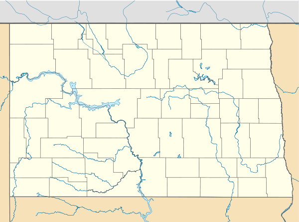 Oriska, North Dakota Location of Oriska, North Dakota | |
| Coordinates: 46°55′53″N 97°47′21″W | |
| Country | United States |
| State | North Dakota |
| County | Barnes |
| Area | |
| • Total | 0.27 sq mi (0.69 km2) |
| • Land | 0.27 sq mi (0.69 km2) |
| • Water | 0.00 sq mi (0.00 km2) |
| Elevation | 1,270 ft (387 m) |
| Population | |
| • Total | 118 |
| • Estimate (2019)[3] | 112 |
| • Density | 419.48/sq mi (162.04/km2) |
| Time zone | UTC-6 (Central (CST)) |
| • Summer (DST) | UTC-5 (CDT) |
| ZIP code | 58063 |
| Area code(s) | 701 |
| FIPS code | 38-59660 |
| GNIS feature ID | 1030575[4] |
History
Oriska was originally called Fourth Siding, and under the latter name was founded in 1872 when the railroad was extended to that point.[6] The name Oriska was adopted in 1881.[7] Oriska was named for a Native American character in a poem by Lydia Sigourney.[8] A post office called Oriska has been in operation since 1881.[9]
Geography
Oriska is located at 46°55′53″N 97°47′21″W (46.931346, -97.789105).[10]
According to the United States Census Bureau, the city has a total area of 0.28 square miles (0.73 km2), all of it land.[11]
Demographics
| Historical population | |||
|---|---|---|---|
| Census | Pop. | %± | |
| 1920 | 300 | — | |
| 1930 | 183 | −39.0% | |
| 1940 | 217 | 18.6% | |
| 1950 | 135 | −37.8% | |
| 1960 | 148 | 9.6% | |
| 1970 | 128 | −13.5% | |
| 1980 | 125 | −2.3% | |
| 1990 | 103 | −17.6% | |
| 2000 | 128 | 24.3% | |
| 2010 | 118 | −7.8% | |
| Est. 2019 | 112 | [3] | −5.1% |
| U.S. Decennial Census[12] 2018 Estimate[13] | |||
2010 census
As of the census[2] of 2010, there were 118 people, 48 households, and 32 families living in the city. The population density was 421.4 inhabitants per square mile (162.7/km2). There were 63 housing units at an average density of 225.0 per square mile (86.9/km2). The racial makeup of the city was 94.9% White, 4.2% from other races, and 0.8% from two or more races. Hispanic or Latino of any race were 4.2% of the population.
There were 48 households, of which 31.3% had children under the age of 18 living with them, 58.3% were married couples living together, 6.3% had a female householder with no husband present, 2.1% had a male householder with no wife present, and 33.3% were non-families. 29.2% of all households were made up of individuals, and 4.2% had someone living alone who was 65 years of age or older. The average household size was 2.46 and the average family size was 3.09.
The median age in the city was 41.3 years. 28% of residents were under the age of 18; 3.4% were between the ages of 18 and 24; 24.6% were from 25 to 44; 33.8% were from 45 to 64; and 10.2% were 65 years of age or older. The gender makeup of the city was 57.6% male and 42.4% female.
2000 census
As of the census of 2000, there were 128 people, 47 households, and 31 families living in the city. The population density was 463.4 people per square mile (176.5/km2). There were 57 housing units at an average density of 206.3 per square mile (78.6/km2). The racial makeup of the city was 98.44% White, and 1.56% from two or more races. Hispanic or Latino of any race were 2.34% of the population.
There were 47 households, out of which 40.4% had children under the age of 18 living with them, 48.9% were married couples living together, 8.5% had a female householder with no husband present, and 34.0% were non-families. 27.7% of all households were made up of individuals, and 8.5% had someone living alone who was 65 years of age or older. The average household size was 2.72 and the average family size was 3.45.
In the city, the population was spread out, with 32.0% under the age of 18, 10.2% from 18 to 24, 30.5% from 25 to 44, 21.1% from 45 to 64, and 6.3% who were 65 years of age or older. The median age was 32 years. For every 100 females, there were 128.6 males. For every 100 females age 18 and over, there were 107.1 males.
The median income for a household in the city was $28,125, and the median income for a family was $26,667. Males had a median income of $18,333 versus $21,250 for females. The per capita income for the city was $10,818. There were 8.3% of families and 14.8% of the population living below the poverty line, including 19.4% of under eighteens and 22.2% of those over 64.
Education
Maple Valley School District operates public schools serving Oriska. An elementary campus is in the town.[14]
References
- "2019 U.S. Gazetteer Files". United States Census Bureau. Retrieved July 27, 2020.
- "U.S. Census website". United States Census Bureau. Retrieved June 14, 2012.
- "Population and Housing Unit Estimates". United States Census Bureau. May 24, 2020. Retrieved May 27, 2020.
- "US Board on Geographic Names". United States Geological Survey. October 25, 2007. Retrieved January 31, 2008.
- "2010 Census Redistricting Data (Public Law 94-171) Summary File". American FactFinder. United States Census Bureau. Retrieved May 2, 2011.
- Olstad, Geneva Roth (2000). Main Street, North Dakota in Vintage Postcards. Arcadia Publishing. p. 80. ISBN 978-0-7385-0726-2.
- North Dakota: Counties, Towns and People. Watchmaker Publishing, Ltd. 2008. p. 16. ISBN 978-1-60386-115-1.
- Kelly, Gary (28 August 2008). Lydia Sigourney: Selected Poetry and Prose. Broadview Press. p. 227. ISBN 978-1-77048-047-6.
- "Barnes County". Jim Forte Postal History. Retrieved October 22, 2015.
- "US Gazetteer files: 2010, 2000, and 1990". United States Census Bureau. February 12, 2011. Retrieved April 23, 2011.
- "US Gazetteer files 2010". United States Census Bureau. Archived from the original on January 12, 2012. Retrieved June 14, 2012.
- United States Census Bureau. "Census of Population and Housing". Retrieved October 31, 2013.
- "Population Estimates". United States Census Bureau. Retrieved September 10, 2019.
- Home. Maple Valley School District. Retrieved on July 17, 2018. "207 Broadway Tower City, ND 58071" and "Serving the communities of Buffalo, Fingal, Oriska and Tower City"
Municipalities and communities of Barnes County, North Dakota, United States | ||
|---|---|---|
| Cities | 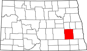 Map of North Dakota highlighting Barnes County | |
| Townships |
| |
| Unincorporated communities | ||
| Footnotes | ‡This populated place also has portions in an adjacent county or counties | |