Orange Township, Clark County, Illinois
Orange Township is one of fifteen townships in Clark County, Illinois, USA. As of the 2010 census, its population was 230 and it contained 114 housing units.[2]
Orange Township | |
|---|---|
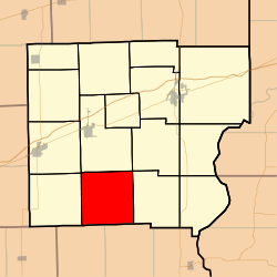 Location in Clark County | |
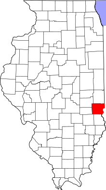 Clark County's location in Illinois | |
| Coordinates: 39°13′22″N 87°50′54″W | |
| Country | United States |
| State | Illinois |
| County | Clark |
| Established | November 7, 1854 |
| Area | |
| • Total | 37.13 sq mi (96.2 km2) |
| • Land | 37.12 sq mi (96.1 km2) |
| • Water | 0 sq mi (0 km2) 0% |
| Elevation | 584 ft (178 m) |
| Population (2010) | |
| • Estimate (2016)[1] | 225 |
| • Density | 6.2/sq mi (2.4/km2) |
| Time zone | UTC-6 (CST) |
| • Summer (DST) | UTC-5 (CDT) |
| ZIP codes | 62413, 62442, 62478 |
| FIPS code | 17-023-56302 |
Geography
According to the 2010 census, the township has a total area of 37.13 square miles (96.2 km2), all land.[2]
Unincorporated towns
(This list is based on USGS data and may include former settlements.)
Cemeteries
The township contains these four cemeteries: Bennett, Butternut, Olive Branch and Wesley Chapel.
School districts
- Martinsville Community Unit School District 3c
Political districts
- Illinois' 15th congressional district
- State House District 109
- State Senate District 55
gollark: Also, you'll get bored.
gollark: Well, you don't actually have either in practice.
gollark: I suppose you *could* just use reasonably small rocks.
gollark: Consider: the osmarks.tk primary server has 1TB of storage, This is 8 trillion bits. At 1 rock per bit, the standard, you need 8 trillion rocks! This is not practical.
gollark: The problem is the large quantity of rocks required.
References
- "Orange Township, Clark County, Illinois". Geographic Names Information System. United States Geological Survey. Retrieved 2010-01-10.
- United States Census Bureau 2007 TIGER/Line Shapefiles
- United States National Atlas
- "Population and Housing Unit Estimates". Retrieved June 9, 2017.
- "Population, Housing Units, Area, and Density: 2010 - County -- County Subdivision and Place -- 2010 Census Summary File 1". United States Census. Archived from the original on 2020-02-12. Retrieved 2013-05-28.
- "Census of Population and Housing". Census.gov. Retrieved June 4, 2016.
External links
Places adjacent to Orange Township, Clark County, Illinois | |
|---|---|
Municipalities and communities of Clark County, Illinois, United States | ||
|---|---|---|
| Cities | Map of Illinois highlighting Clark County | |
| Town | ||
| Townships | ||
| CDP | ||
| Unincorporated communities | ||
| Ghost town | ||
| Footnotes | ‡This populated place also has portions in an adjacent county or counties | |
This article is issued from Wikipedia. The text is licensed under Creative Commons - Attribution - Sharealike. Additional terms may apply for the media files.