Opmeer
Opmeer (![]()
Opmeer | |
|---|---|
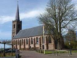 Church in Spanbroek | |
 Flag  Coat of arms | |
.svg.png) Location in North Holland | |
| Coordinates: 52°42′N 4°57′E | |
| Country | Netherlands |
| Province | North Holland |
| Government | |
| • Body | Municipal council |
| • Mayor | GertJan Nijpels (VVD) |
| Area | |
| • Total | 41.94 km2 (16.19 sq mi) |
| • Land | 41.57 km2 (16.05 sq mi) |
| • Water | 0.37 km2 (0.14 sq mi) |
| Elevation | 0 m (0 ft) |
| Population (January 2019)[4] | |
| • Total | 11,779 |
| • Density | 283/km2 (730/sq mi) |
| Demonym(s) | Opmeerder |
| Time zone | UTC+1 (CET) |
| • Summer (DST) | UTC+2 (CEST) |
| Postcode | 1660–1663, 1715–1719 |
| Area code | 0226, 0229 |
| Website | www |
Population centres
The municipality of Opmeer consists of the following cities, towns, villages and/or districts:
Topography
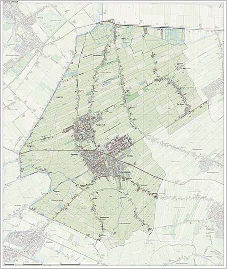
Dutch Topographic map of the municipality of Opmeer, June 2015
Local government
The municipal council of Opmeer consists of 15 seats, which are divided as follows:
The CDA and the Gemeentebelangen Opmeer are in a coalition government.
The town has an online portal with information on services and news.[5]
Notable people
- Hendrik Bosch (1776 in Spanbroek – unknown) a military officer and colonial government official on the Dutch Gold Coast
- Johan Carel Marinus Warnsinck (1882 in Hoogwoud - 1943) a Dutch naval officer and naval historian
- Albert Langereis (1888 in Hoogwoud – 1966) a sports shooter, competed in two events at the 1924 Summer Olympics
- Robert Slippens (born 1975 in Opmeer) a Dutch racing cyclist, competed in three Summer Olympics
Gallery
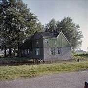 Overzicht van de voormalige burgemeesterswoning, Opmeer
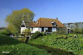 Gouwe, Dorp bij Opmeer
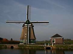 Hoogwoud Molen De Vier Winden met gemaal
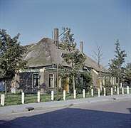 Overzicht van de voorgevel en de linker zijgevel van de boerderij - Spanbroek
gollark: Discord got 🫁 and such lately.
gollark: I have already sent it to two other discord servers. Muahahaha.
gollark: There weren't really combining diacritics pre-unicode.
gollark: I tend to either be excessively paranoid or blindly assume good intentions with little in-between for some reason.
gollark: I actually was able to find this "jmwloup5110" person's LinkedIn account by using the advanced technique of "putting their username into duckduckgo". It looks like they do actually work on... computery things, and not recruiting somehow. This is probably not actually a problem.
References
- "college van Burgemeester en Wethouders" [Board of mayor and aldermen] (in Dutch). Gemeente Opmeer. Archived from the original on 11 August 2014. Retrieved 20 March 2014.
- "Kerncijfers wijken en buurten" [Key figures for neighbourhoods]. CBS Statline (in Dutch). CBS. 2 July 2013. Retrieved 12 March 2014.
- "Postcodetool for 1716VS". Actueel Hoogtebestand Nederland (in Dutch). Het Waterschapshuis. Retrieved 20 March 2014.
- "Bevolkingsontwikkeling; regio per maand" [Population growth; regions per month]. CBS Statline (in Dutch). CBS. 1 January 2019. Retrieved 1 January 2019.
- "Opmeer".
External links

- Official website
Places adjacent to Opmeer | |
|---|---|

| Authority control |
|---|
This article is issued from Wikipedia. The text is licensed under Creative Commons - Attribution - Sharealike. Additional terms may apply for the media files.