Landsmeer
Landsmeer (Dutch pronunciation: [ˌlɑntsˈmeːr] (![]()
Landsmeer | |
|---|---|
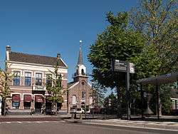 Landsmeer town centre | |
 Flag  Coat of arms | |
.svg.png) Location in North Holland | |
| Coordinates: 52°26′N 4°55′E | |
| Country | Netherlands |
| Province | North Holland |
| Government | |
| • Body | Municipal council |
| • Mayor | Anne Lize van der Stoel (acting) (VVD) |
| Area | |
| • Total | 26.50 km2 (10.23 sq mi) |
| • Land | 22.56 km2 (8.71 sq mi) |
| • Water | 3.94 km2 (1.52 sq mi) |
| Elevation | −1 m (−3 ft) |
| Population (January 2019)[4] | |
| • Total | 11,488 |
| • Density | 509/km2 (1,320/sq mi) |
| Time zone | UTC+1 (CET) |
| • Summer (DST) | UTC+2 (CEST) |
| Postcode | 1120–1127, 1451 |
| Area code | 020 |
| Website | www |
Population centres
The municipality of Landsmeer consists of the three villages: Den Ilp, Landsmeer, Purmerland.
Topography
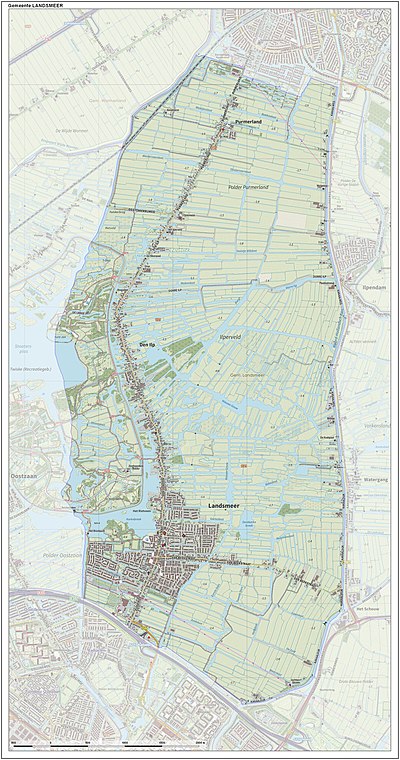
Dutch topographic map of the municipality of Landsmeer, June 2015
Local government
The municipal council of Landsmeer consists of 15 seats, which are divided as follows:
Town twinning
Landsmeer is twinned with the following towns:
|
Notable people
- Sam Olij (1900–1975) a Dutch heavyweight boxer, competed the 1928 Summer Olympics, member of the national socialist NSB party in WW11
- Jaap Oudkerk (born 1937) a retired cyclist, competed the 1960 and 1964 Summer Olympics
- Bernt Schneiders (born 1959) a Dutch politician, Mayor of Landsmeer 1995-2001
- Cor Bakker (born 1961) a Dutch pianist
Gallery
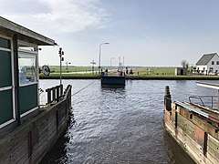 Ferry, Ilpendam - Landsmeer
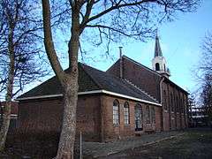 Landsmeer, Little Church
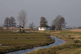 Meadows, polders, windmills and much water in North Holland
 Landsmeer, Dorpsstraat 53
gollark: no.
gollark: Besides, I would HAPPILY have used non-JS languages, just not certain non-JS languages.
gollark: Weren't you just suggesting JS, the language you disliked, as an alternative language for challenges too?
gollark: You didn't think to say "hey, please could you add nonpython options", but just imposed the rule, see.
gollark: ???
References
- "College van burgemeester en wethouders" [Board of mayor and aldermen] (in Dutch). Gemeente Landsmeer. Retrieved 13 March 2014.
- "Kerncijfers wijken en buurten" [Key figures for neighbourhoods]. CBS Statline (in Dutch). CBS. 2 July 2013. Retrieved 12 March 2014.
- "Postcodetool for 1121XC". Actueel Hoogtebestand Nederland (in Dutch). Het Waterschapshuis. Archived from the original on 21 September 2013. Retrieved 13 March 2014.
- "Bevolkingsontwikkeling; regio per maand" [Population growth; regions per month]. CBS Statline (in Dutch). CBS. 1 January 2019. Retrieved 1 January 2019.
External links

- Official website
Places adjacent to Landsmeer | ||||||||||
|---|---|---|---|---|---|---|---|---|---|---|
| ||||||||||

| Authority control |
|
|---|
This article is issued from Wikipedia. The text is licensed under Creative Commons - Attribution - Sharealike. Additional terms may apply for the media files.