Oinoi
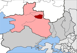
Oinoi (Greek: Οινόη) is a village and a former community in the northern part of West Attica, Greece. The village was named Mazi (Greek: Μάζι) until 1919.[2] Since the 2011 local government reform it is part of the municipality Mandra-Eidyllia, of which it is a municipal unit.[3] The municipal unit has an area of 14.431 km2.[4]
.jpg)
Oinoi Οινόη | |
|---|---|
 Oinoi Location within the regional unit  | |
| Coordinates: 38°10′N 23°24′E | |
| Country | Greece |
| Administrative region | Attica |
| Regional unit | West Attica |
| Municipality | Mandra-Eidyllia |
| • Municipal unit | 14.431 km2 (5.572 sq mi) |
| Elevation | 301 m (988 ft) |
| Population (2011)[1] | |
| • Municipal unit | 382 |
| • Municipal unit density | 26/km2 (69/sq mi) |
| Time zone | UTC+2 (EET) |
| • Summer (DST) | UTC+3 (EEST) |
| Postal code | 190 12 |
| Area code(s) | 22630 |
| Vehicle registration | Z |
| Website | www.inoi.gr |
The ancient site Oenoe is located about 3 km east of the modern settlement of Oinoi. The Greek National Road 3 (Eleusis - Thebes) passes through Oinoi. Oinoi is surrounded by forested mountains, including Pateras (1,131 m (3,711 ft)) and Pastra (1,016 m (3,333 ft)). There are farmlands in the valley areas. Oinoi is located 7 km east of Vilia, 18 km northwest of Eleusis, 19 km southeast of Thebes and 34 km (21 mi) northwest of Athens city centre.
Historical population
| Year | Population |
|---|---|
| 1981 | 241 |
| 1991 | 495 |
| 2001 | 765 |
| 2011 | 382 |
Transport
The Village is served by Oinoi railway station, on the Athens-Chalcis line, with an hourly service in both directions.
References
- "Απογραφή Πληθυσμού - Κατοικιών 2011. ΜΟΝΙΜΟΣ Πληθυσμός" (in Greek). Hellenic Statistical Authority.
- http://www.lithoksou.net/p/metonomasies-ton-oikismon-tis-stereas
- Kallikratis law Greece Ministry of Interior (in Greek)
- "Population & housing census 2001 (incl. area and average elevation)" (PDF) (in Greek). National Statistical Service of Greece.
External links
- Official website (in Greek)
- GTP Travel Pages (Municipality) (in English and Greek)