Oakwood, Texas
Oakwood is a town in Leon and Freestone counties in the U.S. state of Texas. The population was 510 at the 2010 census.[5] It was founded in 1872 as a stop on the International Railroad.[6]
Oakwood, Texas | |
|---|---|
First Christian Church (Disciples of Christ) in Oakwood | |
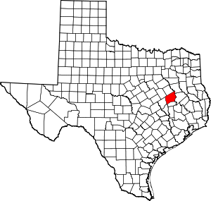
Location of Oakwood, Texas | |
 | |
| Coordinates: 31°35′5″N 95°51′2″W | |
| Country | United States |
| State | Texas |
| Counties | Leon, Freestone |
| Area | |
| • Total | 1.13 sq mi (2.93 km2) |
| • Land | 1.13 sq mi (2.93 km2) |
| • Water | 0.00 sq mi (0.00 km2) |
| Elevation | 279 ft (85 m) |
| Population (2010) | |
| • Total | 510 |
| • Estimate (2019)[2] | 515 |
| • Density | 455.35/sq mi (175.85/km2) |
| Time zone | UTC-6 (Central (CST)) |
| • Summer (DST) | UTC-5 (CDT) |
| ZIP code | 75855 |
| Area code(s) | 903 |
| FIPS code | 48-53232[3] |
| GNIS feature ID | 1375253[4] |
Geography
Oakwood is located in northeastern Leon County at 31°35′5″N 95°51′2″W (31.584816, -95.850666).[7] USGS topographic maps show the northern town boundary following the Leon/Freestone County line, but maps by the U.S. Census show the town extending slightly north into Freestone County.
U.S. Route 79 runs through the town as Broad Street, leading northeast 18 miles (29 km) to Palestine and southwest 15 miles (24 km) to Buffalo.
According to the United States Census Bureau, the town has a total area of 1.13 square miles (2.93 km2), all of it land.[5]
Demographics
| Historical population | |||
|---|---|---|---|
| Census | Pop. | %± | |
| 1880 | 96 | — | |
| 1890 | 231 | 140.6% | |
| 1910 | 906 | — | |
| 1920 | 1,100 | 21.4% | |
| 1930 | 888 | −19.3% | |
| 1940 | 1,086 | 22.3% | |
| 1950 | 759 | −30.1% | |
| 1960 | 716 | −5.7% | |
| 1970 | 547 | −23.6% | |
| 1980 | 606 | 10.8% | |
| 1990 | 527 | −13.0% | |
| 2000 | 471 | −10.6% | |
| 2010 | 510 | 8.3% | |
| Est. 2019 | 515 | [2] | 1.0% |
| U.S. Decennial Census[8] | |||
As of the census[3] of 2000, there were 471 people, 199 households, and 131 families residing in the town. The population density was 429.9 people per square mile (165.3/km2). There were 256 housing units at an average density of 233.7 per square mile (89.9/km2). The racial makeup of the town was 62.42% White, 35.03% African American, 0.21% Native American, 0.21% Asian, 1.70% from other races, and 0.42% from two or more races. Hispanic or Latino of any race were 3.18% of the population.
There were 199 households, out of which 23.6% had children under the age of 18 living with them, 44.2% were married couples living together, 17.1% had a female householder with no husband present, and 33.7% were non-families. 30.2% of all households were made up of individuals, and 16.1% had someone living alone who was 65 years of age or older. The average household size was 2.37 and the average family size was 2.94.
In the town, the population was spread out, with 24.0% under the age of 18, 7.9% from 18 to 24, 19.7% from 25 to 44, 27.6% from 45 to 64, and 20.8% who were 65 years of age or older. The median age was 44 years. For every 100 females, there were 88.4 males. For every 100 females age 18 and over, there were 82.7 males.
The median income for a household in the town was $25,625, and the median income for a family was $33,750. Males had a median income of $34,375 versus $20,938 for females. The per capita income for the town was $16,371. About 13.9% of families and 19.6% of the population were below the poverty line, including 14.3% of those under age 18 and 26.6% of those age 65 or over.
Education
The town is served by the Oakwood Independent School District.
Notable people
- R. H. Bing, mathematician, born in Oakwood on October 20, 1914
- Sarah Lancaster, Sacred Harp composer, lived in Oakwood from the 1880s, died there in 1918 and is buried in the town cemetery[9]
Climate
The climate in this area is characterized by hot, humid summers and generally mild to cool winters. According to the Köppen Climate Classification system, Oakwood has a humid subtropical climate, abbreviated "Cfa" on climate maps.[10]
In popular culture
- "Oakwood", a single by the indie rock trio The Redding Brothers, is about the town where their grandfather, Billy Jack Redding, grew up.
See also
References
- "2019 U.S. Gazetteer Files". United States Census Bureau. Retrieved August 7, 2020.
- "Population and Housing Unit Estimates". United States Census Bureau. May 24, 2020. Retrieved May 27, 2020.
- "U.S. Census website". United States Census Bureau. Retrieved 2008-01-31.
- "US Board on Geographic Names". United States Geological Survey. 2007-10-25. Retrieved 2008-01-31.
- "Geographic Identifiers: 2010 Demographic Profile Data (G001): Oakwood town, Texas". U.S. Census Bureau, American Factfinder. Retrieved September 6, 2016.
- A Memorial and Biographical History of Navarro, Henderson, Anderson, Limestone, Freestone and Leon Counties, Texas. Chicago: Lewis Publishing Company. 1893. p. 468. Retrieved 28 September 2014.
- "US Gazetteer files: 2010, 2000, and 1990". United States Census Bureau. 2011-02-12. Retrieved 2011-04-23.
- "Census of Population and Housing". Census.gov. Retrieved June 4, 2015.
- David Warren Steel; Richard H. Hulan (2010). The Makers of the Sacred Harp. University of Illinois Press. pp. 131–. ISBN 978-0-252-07760-9.
- Climate Summary for Oakwood, Texas
External links
| Wikimedia Commons has media related to Oakwood, Texas. |

