Nitta Yuma, Mississippi
Nitta Yuma is an unincorporated community located in Sharkey County, Mississippi, United States.[1] Nitta Yuma is located along U.S. Route 61, approximately four miles north of Anguilla.
Nitta Yuma, Mississippi | |
|---|---|
 Nitta Yuma  Nitta Yuma | |
| Coordinates: 33°01′27″N 90°50′57″W | |
| Country | United States |
| State | Mississippi |
| County | Sharkey |
| Elevation | 112 ft (34 m) |
| Time zone | UTC-6 (Central (CST)) |
| • Summer (DST) | UTC-5 (CDT) |
| Area code(s) | 662 |
| GNIS feature ID | 674927[1] |
Nitta Yuma is a name derived from the Choctaw language purported to mean "mixed with bear".[2]
Climate
The climate in this area is characterized by relatively high temperatures and evenly distributed precipitation throughout the year. According to the Köppen Climate Classification system, Nitta Yuma has a Humid subtropical climate, abbreviated "Cfa" on climate maps.[3]
Gallery
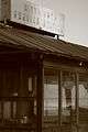 An old Nitta Yuma gas station. Picture taken while driving up 61 North
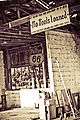
gollark: This is due to GPS good.
gollark: https://hackaday.com/2022/06/23/around-gps-in-100-videos/
gollark: You should only do courses on important specific topics, such as all of GPS.
gollark: Maybe in *electromagnetism*.
gollark: Cesium ones and the maser things are quite niche.
References
- "Nitta Yuma, Mississippi". Geographic Names Information System. United States Geological Survey.
- Baca, Keith A. (2007). Native American Place Names in Mississippi. University Press of Mississippi. p. 64. ISBN 978-1-60473-483-6.
- Climate Summary for Nitta Yuma
External links
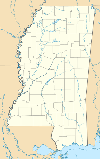
Municipalities and communities of Sharkey County, Mississippi, United States | ||
|---|---|---|
| City | 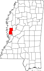 Map of Mississippi highlighting Sharkey County | |
| Towns | ||
| Unincorporated communities | ||
| Ghost towns |
| |
This article is issued from Wikipedia. The text is licensed under Creative Commons - Attribution - Sharealike. Additional terms may apply for the media files.