New Hampshire Route 137
New Hampshire Route 137 (abbreviated NH 137) is a 16.583-mile-long (26.688 km) secondary north–south state highway in southern New Hampshire. The road runs between Jaffrey and Hancock.
| ||||
|---|---|---|---|---|
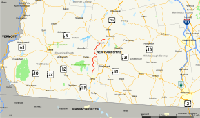 Map of southern New Hampshire with NH 137 highlighted in red | ||||
| Route information | ||||
| Maintained by NHDOT | ||||
| Length | 16.583 mi[1] (26.688 km) | |||
| Major junctions | ||||
| South end | ||||
| North end | ||||
| Location | ||||
| Counties | Cheshire, Hillsborough | |||
| Highway system | ||||
| ||||

The southern terminus of NH 137 is at U.S. Route 202 and New Hampshire Route 124 in Jaffrey. In Jaffrey, NH 137 is named North Street. The northern terminus is northeast of Hancock center at US 202 along the west side of Powder Mill Pond at the Bennington town line.
Major intersections
| County | Location[1][2] | mi[1][2] | km | Destinations | Notes |
|---|---|---|---|---|---|
| Cheshire | Jaffrey | 0.00 | 0.00 | Southern terminus | |
| Dublin | 6.518 | 10.490 | |||
| Hillsborough | Hancock | 13.488 | 21.707 | Southern end of wrong-way concurrency with NH 123 | |
| 13.664 | 21.990 | Northern end of wrong-way concurrency with NH 123 | |||
| 16.583 | 26.688 | Northern terminus | |||
1.000 mi = 1.609 km; 1.000 km = 0.621 mi
| |||||
gollark: PotatOS.
gollark: <@330678593904443393> There are rules where spaceships can reach c, you know.
gollark: I am in earth hemisphere.
gollark: That's what we use [ALL OTHER CHANNELS] for.
gollark: ++exec```haskellimport Unsafe.Coercedata Would = Seriously Int deriving Showtype Mad = ()data Are = Are Mad deriving Showtype Is = Aredata You = You Are Mad deriving Showdata Thing = This Thing Is Mad deriving Showdata This = Thing Mad deriving Shownewtype Do = Do (Thing -> You -> [Thing])data Why = Why Would You Do This deriving Showinstance Show Do where show x = "Do the thing!"why :: Whywhy = Why would you do_ this where would = Seriously 0 you = You (Are ()) () do_ = Do $ \_ _ -> [] this = Thing ()main = print why```
References
- Bureau of Planning & Community Assistance (February 20, 2015). "NH Public Roads". Concord, New Hampshire: New Hampshire Department of Transportation. Retrieved April 7, 2015.
- Bureau of Planning & Community Assistance (April 3, 2015). "Nodal Reference 2015, State of New Hampshire". New Hampshire Department of Transportation. Retrieved April 7, 2015.
This article is issued from Wikipedia. The text is licensed under Creative Commons - Attribution - Sharealike. Additional terms may apply for the media files.