National Register of Historic Places listings in Arapahoe County, Colorado
This is a list of the National Register of Historic Places listings in Arapahoe County, Colorado.
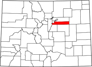
Location of Arapahoe County in Colorado
This is intended to be a complete list of the properties and districts on the National Register of Historic Places in Arapahoe County, Colorado, United States. The locations of National Register properties and districts for which the latitude and longitude coordinates are included below, may be seen in a map.[1]
There are 24 properties and districts listed on the National Register in the county.
- This National Park Service list is complete through NPS recent listings posted August 14, 2020.[2]
| Adams - Alamosa - Arapahoe - Archuleta - Baca - Bent - Boulder - Broomfield - Chaffee - Cheyenne - Clear Creek - Conejos - Costilla - Crowley - Custer - Delta - Denver - Dolores - Douglas - Eagle - El Paso - Elbert - Fremont - Garfield - Gilpin - Grand - Gunnison - Hinsdale - Huerfano - Jackson - Jefferson - Kiowa - Kit Carson - La Plata - Lake - Larimer - Las Animas - Lincoln - Logan - Mesa - Mineral - Moffat - Montezuma - Montrose - Morgan - Otero - Ouray - Park - Phillips - Pitkin - Prowers - Pueblo - Rio Blanco - Rio Grande - Routt - Saguache - San Juan - San Miguel - Sedgwick - Summit - Teller - Washington - Weld - Yuma |
Current listings
| [3] | Name on the Register[4] | Image | Date listed[5] | Location | City or town | Description |
|---|---|---|---|---|---|---|
| 1 | Arapahoe Acres | 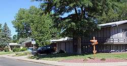 Arapahoe Acres |
November 3, 1998 (#98001249) |
Roughly bounded by W. Bates and Dartmouth Aves. and S. Marion and Franklin Sts. 39°39′44″N 104°58′13″W |
Englewood | |
| 2 | Arapaho Hills | Arapaho Hills |
August 28, 2012 (#12000550) |
Bounded by Arrowhead, W. Berry, & S. Manitou Rds., S. Lowell Blvd. 39°37′07″N 105°02′12″W |
Littleton | part of the Residential Subdivisions of Metropolitan Denver, 1940-1965 Multiple Property Submission (MPS) |
| 3 | David W. Brown House | 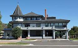 David W. Brown House |
April 10, 1980 (#80000875) |
2303 E. Dartmouth Ave. 39°39′38″N 104°57′38″W |
Englewood | |
| 4 | Comanche Crossing of the Kansas Pacific Railroad | 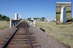 Comanche Crossing of the Kansas Pacific Railroad |
August 10, 1970 (#70000152) |
On Union Pacific Railroad tracks east of the Strasburg depot 39°44′15″N 104°18′29″W |
Strasburg | |
| 5 | Commandant of Cadets Building, US Air Force Academy | 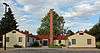 Commandant of Cadets Building, US Air Force Academy |
April 24, 2007 (#07000340) |
1016 Boston St. 39°43′48″N 104°52′41″W |
Aurora | |
| 6 | Curtis School | 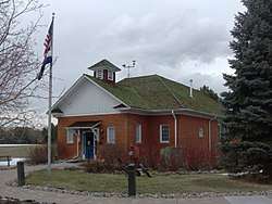 Curtis School |
June 25, 1992 (#92000808) |
2349 E. Orchard Rd. 39°36′37″N 104°57′37″W |
Greenwood Village | part of the Rural School Buildings in Colorado MPS |
| 7 | DeLaney Barn | 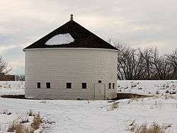 DeLaney Barn |
February 9, 1989 (#89000010) |
200 S. Chambers Rd. 39°42′48″N 104°48′27″W |
Aurora | |
| 8 | Englewood Post Office | Englewood Post Office |
July 20, 2011 (#11000465) |
3332 S. Broadway 39°39′22″N 104°59′14″W |
Englewood | |
| 9 | Foster-Buell Estate | April 1, 1998 (#98000294) |
2700 E. Hampden Ave. 39°38′50″N 104°57′01″W |
Cherry Hills Village | ||
| 10 | Geneva Home | 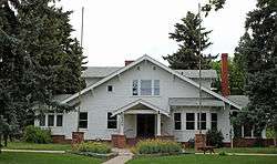 Geneva Home |
January 21, 1999 (#98001635) |
2305 W. Berry Ave. 39°37′04″N 105°00′53″W |
Littleton | |
| 11 | Gully Homestead | 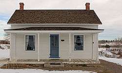 Gully Homestead |
January 9, 1986 (#86000022) |
200 S. Chambers Rd. 39°42′44″N 104°48′32″W |
Aurora | |
| 12 | Hopkins Farm | 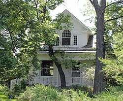 Hopkins Farm |
April 24, 2007 (#07000341) |
4400 E. Quincy Ave. 39°38′15″N 104°56′17″W |
Cherry Hills Village | |
| 13 | Jamaica Primary School | Jamaica Primary School |
May 1, 2017 (#100000928) |
800 Jamaica St. 39°43′45″N 104°51′47″W |
Aurora | |
| 14 | Key Savings and Loan Association Building |  Key Savings and Loan Association Building |
July 18, 2016 (#16000447) |
3501 S. Broadway 39°39′11″N 104°59′16″W |
Englewood | |
| 15 | Knight-Wood House | 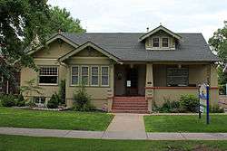 Knight-Wood House |
October 6, 2004 (#04001111) |
1860 W. Littleton Boulevard 39°36′47″N 105°00′34″W |
Littleton | |
| 16 | Little Estate | 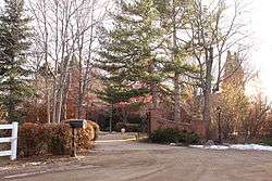 Little Estate |
May 29, 1998 (#98000610) |
1 Littleridge Ln. 39°38′58″N 104°58′10″W |
Cherry Hills Village | |
| 17 | Littleton Main Street | Littleton Main Street |
April 8, 1998 (#98000291) |
Roughly along W. Main St. from S. Curtice St. to S. Sycamore St. 39°36′50″N 105°00′58″W |
Littleton | |
| 18 | Littleton Post Office | .JPG) Littleton Post Office |
April 26, 2019 (#100003671) |
5753 S. Prince St. 39°37′09″N 105°00′58″W |
Littleton | |
| 19 | Littleton Town Hall | 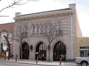 Littleton Town Hall |
September 4, 1980 (#80000876) |
2450 W. Main St. 39°36′48″N 105°00′59″W |
Littleton | |
| 20 | Maitland Estate | 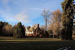 Maitland Estate |
September 3, 1998 (#98001130) |
9 Sunset Dr. 39°38′52″N 104°57′35″W |
Cherry Hills Village | |
| 21 | Melvin School | 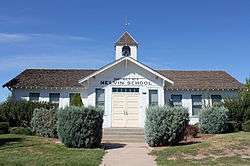 Melvin School |
January 5, 1984 (#84000790) |
4950 S. Laredo St. 39°37′34″N 104°48′09″W |
Aurora | part of the Rural School Buildings in Colorado MPS |
| 22 | Owen Estate | 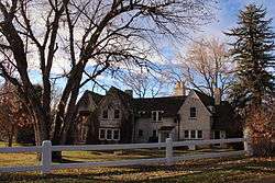 Owen Estate |
September 17, 1999 (#99001143) |
3901 S. Gilpin St. 39°38′50″N 104°58′03″W |
Cherry Hills Village | |
| 23 | Seventeen Mile House | 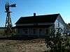 Seventeen Mile House |
October 6, 1983 (#83003501) |
8181 S. Parker Rd. 39°34′05″N 104°47′14″W |
Centennial | |
| 24 | William Smith House | 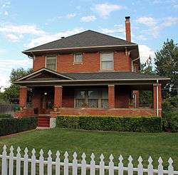 William Smith House |
September 26, 1985 (#85002565) |
412 Oswego Ct. 39°43′17″N 104°50′58″W |
Aurora |
gollark: How is allow(unused_variables) to do anything itself? It just needs to tell the linter that.
gollark: Which may as well have syntax anyway.
gollark: You need a way to attach metadata to the ASTs for this to make sense.
gollark: I feel like this is actually bad.
gollark: Attributes are functions of macron to AST.
See also
| Wikimedia Commons has media related to National Register of Historic Places in Arapahoe County, Colorado. |
References
- The latitude and longitude information provided in this table was derived originally from the National Register Information System, which has been found to be fairly accurate for about 99% of listings. Some locations in this table may have been corrected to current GPS standards.
- "National Register of Historic Places: Weekly List Actions". National Park Service, United States Department of the Interior. Retrieved on August 14, 2020.
- Numbers represent an ordering by significant words. Various colorings, defined here, differentiate National Historic Landmarks and historic districts from other NRHP buildings, structures, sites or objects.
- "National Register Information System". National Register of Historic Places. National Park Service. July 9, 2010.
- The eight-digit number below each date is the number assigned to each location in the National Register Information System database, which can be viewed by clicking the number.
| Topics | |
|---|---|
| Lists by state |
|
| Lists by insular areas | |
| Lists by associated state | |
| Other areas | |
| Related | |
| |
Municipalities and communities of Arapahoe County, Colorado, United States | ||
|---|---|---|
| Cities | Map of Colorado highlighting Arapahoe County | |
| Towns | ||
| CDPs | ||
| Footnotes | ‡This populated place also has portions in an adjacent county or counties | |
This article is issued from Wikipedia. The text is licensed under Creative Commons - Attribution - Sharealike. Additional terms may apply for the media files.