Nasrullaganj
Nasrullaganj is a Nagar panchayat in Sehore district in the Indian state of Madhya Pradesh. Nearest airport Bhopal.
Nasrullaganj (Bherunda)(भेरूंंदा) | |
|---|---|
Town | |
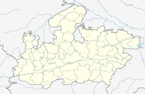
 Location in Madhya Pradesh, India  Nasrullaganj (India)  Nasrullaganj (Asia) | |
| Coordinates: 22°40′58″N 77°16′26″E | |
| Country | |
| State | Madhya Pradesh |
| District | Sehore |
| Government | |
| • Type | Nagar Parishad |
| • Body | B.J.P. |
| Area | |
| • Total | 5 km2 (2 sq mi) |
| Population (2001) | |
| • Total | 17,240 |
| • Density | 3,400/km2 (8,900/sq mi) |
| Language | |
| • Official | Hindi[1] |
| Time zone | UTC5:30 (IST) |
| ISO 3166 code | IN-MP |
| Vehicle registration | MP 37 |
Location
Nasrullaganj 90 Km from state capital Bhopal.
Demographics
Nasrullaganj is a Nagar Panchayat city in district of Sehore, Madhya Pradesh. The Nasrullaganj Nagar Panchayat has a population of 17,240 of which 9,271 are males while 7,969 are females as per report released by Census India 2001. Population of children with age of 0-6 is 2,542. In Nasrullaganj Nagar Panchayat, Female Sex Ratio is of 860. Moreover, Child Sex Ratio in Nasrullaganj is around 796. Literacy rate of Nasrullaganj is 66.10% of which male literacy is around 73.8% while female literacy rate is 57.13%.[2]
Transportation
Nasrullaganj is around 80–90 km from Bhopal and around 169km from indore by road.
Nasrullaganj within 100 km of the five major railway stations namely, Budhni (50 km), Hoshangabad (60 km), Itarsi (75 km) and Sehore (78 km).
Airports in Bhopal, Raja Bhoj Airport and Indore, Devi Ahilya Bai Holkar Airport are nearest.
References
- "52nd REPORT OF THE COMMISSIONER FOR LINGUISTIC MINORITIES IN INDIA" (PDF). nclm.nic.in. Ministry of Minority Affairs. Archived from the original (PDF) on 25 May 2017. Retrieved 28 August 2019.
- "Table - 3 : Population, population in the age group 0-6 and literates by sex - Cities/Towns (in alphabetic order): 2001". census.gov.in. Archived from the original on 16 June 2004. Retrieved 28 August 2019.