Mount Kerkeslin
Mount Kerkeslin is a 2,956 m (9,698 ft) mountain summit located in the Athabasca River valley of Jasper National Park, in the Canadian Rockies of Alberta, Canada.[2] It is the highest peak of the Maligne Range. It is located in the south part of the Maligne Range, east of the Icefields Parkway and is visible from the Athabasca Falls lookout. Mount Kerkeslin is composed of sedimentary rock laid down during the Cambrian period and pushed east and over the top of younger rock during the Laramide orogeny.[3]
| Mount Kerkeslin | |
|---|---|
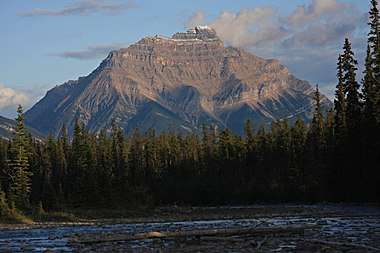
.jpg) Mount Kerkeslin seen from Athabasca Falls | |
| Highest point | |
| Elevation | 2,956 m (9,698 ft) |
| Prominence | 730 m (2,400 ft) |
| Coordinates | 52°38′56″N 117°49′36″W [1] |
| Geography | |
 Mount Kerkeslin Mount Kerkeslin in Alberta  Mount Kerkeslin Mount Kerkeslin (Canada) | |
| Location | Alberta |
| Parent range | Maligne Range |
| Topo map | NTS 83C/13 |
| Climbing | |
| First ascent | 1926 by F.H. Slark, guided by J. Weber |
Climate
Based on the Köppen climate classification, Mount Kerkeslin is located in a subarctic climate with cold, snowy winters, and mild summers.[4] Temperatures can drop below -20 °C with wind chill factors below -30 °C. Precipitation runoff from Mount Kerkeslin drains into the Athabasca River.
See also
- Mountains of Alberta
- Geography of Alberta
References
- Bivuac. "Mount Kerkeslin". Retrieved 2010-01-09.
- Peak Finder. "Mount Kerkeslin". Retrieved 2010-01-09.
- Gadd, Ben (2008). "Geology of the Rocky Mountains and Columbias". Cite journal requires
|journal=(help) - Peel, M. C.; Finlayson, B. L. & McMahon, T. A. (2007). "Updated world map of the Köppen−Geiger climate classification". Hydrol. Earth Syst. Sci. 11: 1633–1644. ISSN 1027-5606.
External links
- Parks Canada web site: Jasper National Park
- Mount Kerkeslin weather: Mountain Forecast