Mount Assiniboine
Mount Assiniboine, also known as Assiniboine Mountain, is a pyramidal peak mountain located on the Great Divide, on the British Columbia/Alberta border in Canada.
| Mount Assiniboine | |
|---|---|
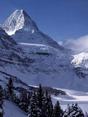 Mount Assiniboine seen from above Lake Magog | |
| Highest point | |
| Elevation | 3,618 m (11,870 ft) [1] |
| Prominence | 2,086 m (6,844 ft) [2] |
| Listing |
|
| Coordinates | 50°52′10″N 115°39′03″W [3] |
| Geography | |
 Mount Assiniboine Location in Alberta, on the border with British Columbia  Mount Assiniboine Mount Assiniboine (British Columbia) | |
| Location | Alberta–British Columbia border, Canada |
| Parent range | Canadian Rockies (Assiniboine Area) |
| Topo map | NTS 82J/13 Mount Assiniboine[3] |
| Climbing | |
| First ascent | 1901 by James Outram, Christian Bohren and Christian Hasler[4] |
| Easiest route | rock/snow climb (II/5.5)[1] |
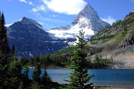
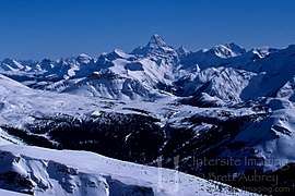
At 3,618 m (11,870 ft), it is the highest peak in the Southern Continental Ranges of the Canadian Rockies. Mt. Assiniboine rises nearly 1,525 m (5,003 ft) above Lake Magog. Because of its resemblance to the Matterhorn in the Alps, it is nicknamed the "Matterhorn of the Rockies".[5]
Mt. Assiniboine was named by George M. Dawson in 1885. When Dawson saw Mt. Assiniboine from Copper Mountain, he saw a plume of clouds trailing away from the top. This reminded him of the plumes of smoke emanating from the teepees of Assiniboine Indians.[1]
Mt. Assiniboine lies on the border between Mount Assiniboine Provincial Park, in British Columbia, and Banff National Park, in Alberta.[6] The park does not have any roads and thus can only be reached by a six-hour hike or horse-pack 27 km (17 mi), three-hour bike ride (now disallowed to reduce human / grizzly encounters) or helicopter. The usual approach is via Bryant Creek. From Canmore follow the Smith-Dorien road to the Mount Shark parking lot. The trail is well signed. A helipad is also here.
Climbing
Mt. Assiniboine was first climbed in the summer of 1901 by James Outram, Christian Bohren and Christian Hasler.[4] In 1925, Lawrence Grassi became the first person to make a solo ascent. On August 27, 2001, Bohren's granddaughter Lonnie along with three others made a successful ascent, celebrating the 100th anniversary of the first ascent.[1]
There are no scrambling routes up Mt. Assiniboine. The easiest mountaineering routes are the North Ridge and North Face at YDS 5.5 which are reached from the Hind Hut.
See also
References
- "Mount Assiniboine". PeakFinder.com. Retrieved 2003-11-02.
- "Mount Assiniboine". Bivouac.com. Retrieved 2007-06-10.
- "Mount Assiniboine". Geographical Names Data Base. Natural Resources Canada. Retrieved 2019-09-15.
- "Mount Assiniboine Provincial Park". BC Parks. Retrieved 2018-10-05.
- Sandford, Robert W. (2010). Ecology & Wonder in the Canadian Rocky Mountain Parks World Heritage Site. Athabasca University Press. p. 60. ISBN 9781897425572. Retrieved 2018-10-05.
- "Map of Mount Assiniboine Provincial Park" (PDF). BC Parks. February 28, 2018. Retrieved 2019-09-15.
External links

- Biv Home Mount Assiniboine in Canadian Mountain Encyclopedia (Bivouac.com)
- SummitPost - Mt. Assiniboine
- "Mount Assiniboine". Peakware.com. Archived from the original on 2016-03-04.
- "Mount Assiniboine, Alberta/British Columbia". Peakbagger.com.
- ACC - Accident history