Mortons Gap, Kentucky
Mortons Gap is a home rule-class city in Hopkins County, Kentucky, in the United States. The population was 863 at the 2010 census,[4] down from 952 at the 2000 census.
Mortons Gap, Kentucky | |
|---|---|
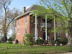 The W.W. Kington House, a local landmark | |
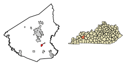 Location of Mortons Gap in Hopkins County, Kentucky. | |
| Coordinates: 37°14′17″N 87°28′25″W | |
| Country | United States |
| State | Kentucky |
| County | Hopkins |
| Incorporated | 1888[1] |
| Named for | a local landowner |
| Area | |
| • Total | 1.19 sq mi (3.09 km2) |
| • Land | 1.18 sq mi (3.07 km2) |
| • Water | 0.01 sq mi (0.02 km2) |
| Elevation | 472 ft (144 m) |
| Population (2010) | |
| • Total | 863 |
| • Estimate (2019)[3] | 826 |
| • Density | 697.64/sq mi (269.34/km2) |
| Time zone | UTC-6 (Central (CST)) |
| • Summer (DST) | UTC-5 (CDT) |
| ZIP code | 42440 |
| Area code(s) | 270 & 364 |
| FIPS code | 21-53616 |
| GNIS feature ID | 0498645 |
| Website | mortonsgap |
Name
The city is named for Thomas Morton, who settled the area in 1804,[5] but it is now spelled without an apostrophe by the city,[6] the state land office,[1] and the U.S. Board on Geographic Names.[7] The eponymous gap is now traversed by U.S. Route 41.
Geography
Mortons Gap is located in southeastern Hopkins County at 37°14′17″N 87°28′25″W (37.238098, -87.473484).[8] Via U.S. 41 it is 7 miles (11 km) south of Madisonville, the county seat, and 3 miles (5 km) north of Nortonville. Interstate 69 passes east of Mortons Gap, with access from Exit 37, an area which has recently been annexed by the city. I-69 leads north past Madisonville 43 miles (69 km) to Henderson and south 2 miles (3 km) to the Western Kentucky Parkway. Hopkinsville is 28 miles (45 km) south of Mortons Gap via I-69 and the Pennyrile Parkway.
According to the United States Census Bureau, the city of Mortons Gap has a total area of 1.2 square miles (3.0 km2), of which 0.01 square miles (0.02 km2), or 0.63%, are water.[4]
Demographics
| Historical population | |||
|---|---|---|---|
| Census | Pop. | %± | |
| 1880 | 241 | — | |
| 1890 | 548 | 127.4% | |
| 1900 | 885 | 61.5% | |
| 1910 | 1,266 | 43.1% | |
| 1920 | 1,061 | −16.2% | |
| 1930 | 1,068 | 0.7% | |
| 1940 | 1,072 | 0.4% | |
| 1950 | 1,081 | 0.8% | |
| 1960 | 1,308 | 21.0% | |
| 1970 | 1,169 | −10.6% | |
| 1980 | 1,201 | 2.7% | |
| 1990 | 987 | −17.8% | |
| 2000 | 952 | −3.5% | |
| 2010 | 863 | −9.3% | |
| Est. 2019 | 826 | [3] | −4.3% |
| U.S. Decennial Census[9] | |||
As of the census[10] of 2000, there were 952 people, 396 households, and 283 families residing in the city. The population density was 987.4 people per square mile (382.9/km2). There were 447 housing units at an average density of 463.6 per square mile (179.8/km2). The racial makeup of the city was 95.59% White, 3.26% Black or African American, 0.11% Asian, 0.32% from other races, and 0.74% from two or more races. Hispanic or Latino of any race were 0.21% of the population.
There were 396 households, of which 27.5% had children under the age of 18 living with them, 55.1% were married couples living together, 13.6% had a female householder with no husband present, and 28.3% were non-families. 26.0% of all households were made up of individuals, and 14.6% had someone living alone who was 65 years of age or older. The average household size was 2.40 and the average family size was 2.87.
In the city, the population was spread out, with 22.6% under the age of 18, 10.2% from 18 to 24, 28.5% from 25 to 44, 21.2% from 45 to 64, and 17.5% who were 65 years of age or older. The median age was 38 years. For every 100 females, there were 88.5 males. For every 100 females age 18 and over, there were 81.1 males.
The median income for a household in the city was $27,031, and the median income for a family was $34,276. Males had a median income of $28,333 versus $17,105 for females. The per capita income for the city was $13,875. About 10.9% of families and 13.9% of the population were below the poverty line, including 18.4% of those under age 18 and 10.3% of those age 65 or over.
Local schools
Mortons Gap had a community school built in the 1930s and housed a high school until the high school's consolidation to South Hopkins High School in 1955. An elementary and middle school continued to be served at the same location, until the elementary school was consolidated to form Southside Elementary School and the middle school to form South Hopkins Middle School in the mid-1990s. The former school has been renovated and serves the community as a church.
References
- Commonwealth of Kentucky. Office of the Secretary of State. Land Office. "Mortons Gap, Kentucky". Accessed 26 August 2013.
- "2019 U.S. Gazetteer Files". United States Census Bureau. Retrieved July 24, 2020.
- "Population and Housing Unit Estimates". United States Census Bureau. May 24, 2020. Retrieved May 27, 2020.
- "Geographic Identifiers: 2010 Demographic Profile Data (G001): Mortons Gap city, Kentucky". American Factfinder. U.S. Census Bureau. Retrieved July 6, 2017.
- "Dictionary of Places: Morton's Gap". Encyclopedia of Kentucky. New York, New York: Somerset Publishers. 1987. ISBN 0-403-09981-1.
- "Mortons Gap"
- GNIS Detail. "Mortons Gap". Accessed 26 August 2013.
- "US Gazetteer files: 2010, 2000, and 1990". United States Census Bureau. 2011-02-12. Retrieved 2011-04-23.
- "Census of Population and Housing". Census.gov. Retrieved June 4, 2015.
- "U.S. Census website". United States Census Bureau. Retrieved 2008-01-31.
Municipalities and communities of Hopkins County, Kentucky, United States | ||
|---|---|---|
| Cities |  Location of Hopkins County, Kentucky | |
| CDP | ||
| Other unincorporated communities | ||
| Footnotes | ‡This populated place also has portions in an adjacent county or counties | |