Montjoi, Aude
Montjoi is a commune in the Aude department in southern France.
Montjoi | |
|---|---|
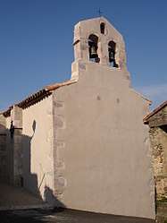 The church in Montjoi | |
.svg.png) Coat of arms | |
Location of Montjoi 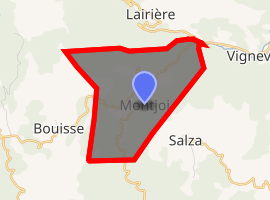
| |
 Montjoi  Montjoi | |
| Coordinates: 42°59′37″N 2°28′59″E | |
| Country | France |
| Region | Occitanie |
| Department | Aude |
| Arrondissement | Narbonne |
| Canton | Les Corbières |
| Intercommunality | Massif de Mouthoumet |
| Government | |
| • Mayor (2008–2014) | Gerda Gazel |
| Area 1 | 7.18 km2 (2.77 sq mi) |
| Population (2017-01-01)[1] | 37 |
| • Density | 5.2/km2 (13/sq mi) |
| Time zone | UTC+01:00 (CET) |
| • Summer (DST) | UTC+02:00 (CEST) |
| INSEE/Postal code | 11250 /11330 |
| Elevation | 249–875 m (817–2,871 ft) (avg. 350 m or 1,150 ft) |
| 1 French Land Register data, which excludes lakes, ponds, glaciers > 1 km2 (0.386 sq mi or 247 acres) and river estuaries. | |
Geography
The commune is located in the Corbières Massif.
The village lies in the middle of the commune, high above the left bank of the Orbieu, which flows northeast through the commune.
Population
| Year | Pop. | ±% |
|---|---|---|
| 1962 | 32 | — |
| 1968 | 45 | +40.6% |
| 1975 | 34 | −24.4% |
| 1982 | 34 | +0.0% |
| 1990 | 27 | −20.6% |
| 1999 | 28 | +3.7% |
| 2008 | 42 | +50.0% |
gollark: A 2D Fourier transform of some image or other.
gollark: I think they just have a function to get the next thing on each end.
gollark: FEAR algorithms I guess.
gollark: Wow! My phone autocompleted magnetohydrodynamics.
gollark: Relativistic quantum magnetohydrodynamics.
See also
References
- "Populations légales 2017". INSEE. Retrieved 6 January 2020.
| Wikimedia Commons has media related to Montjoi, Aude. |
| Authority control |
|
|---|
This article is issued from Wikipedia. The text is licensed under Creative Commons - Attribution - Sharealike. Additional terms may apply for the media files.