Monroe Township, Morgan County, Indiana
Monroe Township is one of fourteen townships in Morgan County, Indiana, United States. As of the 2010 census, its population was 4,904 and it contained 1,917 housing units.[1]
Monroe Township | |
|---|---|
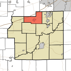 Location in Morgan County | |
| Coordinates: 39°34′58″N 86°28′50″W | |
| Country | |
| State | |
| County | Morgan |
| Government | |
| • Type | Indiana township |
| Area | |
| • Total | 26.62 sq mi (68.9 km2) |
| • Land | 26.47 sq mi (68.6 km2) |
| • Water | 0.15 sq mi (0.4 km2) 0.56% |
| Elevation | 797 ft (243 m) |
| Population (2010) | |
| • Total | 4,904 |
| • Density | 185.2/sq mi (71.5/km2) |
| Time zone | UTC-5 (Eastern (EST)) |
| • Summer (DST) | UTC-4 (EDT) |
| ZIP codes | 46118, 46151, 46157, 46158 |
| GNIS feature ID | 453643 |
History
The Lake Ditch Bridge was listed on the National Register of Historic Places in 2001.[2]
Geography
According to the 2010 census, the township has a total area of 26.62 square miles (68.9 km2), of which 26.47 square miles (68.6 km2) (or 99.44%) is land and 0.15 square miles (0.39 km2) (or 0.56%) is water.[1]
Cities, towns, villages
Unincorporated towns
- Allman at 39.617269°N 86.431106°W
- Bunker Hill at 39.566436°N 86.441384°W
- Gasburg at 39.594491°N 86.43694°W
- Lake Hart at 39.567547°N 86.431939°W
(This list is based on USGS data and may include former settlements.)
Cemeteries
The township contains these two cemeteries: Bethesda and North Branch.
Major highways
Airports and landing strips
- Berling Airport
Lakes
- Echo Lake
- Hart Lake
School districts
- Monroe-Gregg School District
Political districts
- Indiana's 4th congressional district
- State House District 47
- State Senate District 37
gollark: Oh, souls? I have 22Tsouls.
gollark: I wrote #3.
gollark: What happened to people getting to see the test sÜites?
gollark: There are various Python JVM libraries I can [REDACTED].
gollark: You might not be able to load a source file (or at least not without the JDK? I never checked) but you can totally load precompiled classes.
References
- "Monroe Township, Morgan County, Indiana". Geographic Names Information System. United States Geological Survey. Retrieved 2009-09-26.
- United States Census Bureau 2008 TIGER/Line Shapefiles
- IndianaMap
- "Population, Housing Units, Area, and Density: 2010 - County -- County Subdivision and Place -- 2010 Census Summary File 1". United States Census. Archived from the original on 2020-02-12. Retrieved 2013-05-10.
- "National Register Information System". National Register of Historic Places. National Park Service. July 9, 2010.
External links
- Indiana Township Association
- United Township Association of Indiana
- City-Data.com page for Monroe Township
Places adjacent to Monroe Township, Morgan County, Indiana | |
|---|---|
Municipalities and communities of Morgan County, Indiana, United States | ||
|---|---|---|
| City | Map of Indiana highlighting Morgan County | |
| Towns | ||
| Townships | ||
| CDP | ||
| Other unincorporated communities |
| |
| Footnotes | ‡This populated place also has portions in an adjacent county or counties | |
This article is issued from Wikipedia. The text is licensed under Creative Commons - Attribution - Sharealike. Additional terms may apply for the media files.