Moncreiffe Island
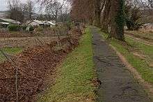
Moncreiffe Island, also known as Friarton Island, is an island in Perth, Scotland. It divides the River Tay into two channels as it flows through Perth, and is crossed by the railway line to Dundee.
| Gaelic name | Monadh Craoibhe |
|---|---|
| Meaning of name | Moorland of the Tree |
| Location | |
 Moncreiffe Island Moncreiffe Island shown within Scotland | |
| OS grid reference | NO122220 |
| Coordinates | 56.38°N 3.42°W |
| Physical geography | |
| Island group | River Tay |
| Area | 46 ha (110 acres) |
| Area rank | 209 (Freshwater: 7) [1] |
| Highest elevation | 5 m (16 ft) |
| Administration | |
| Sovereign state | United Kingdom |
| Country | Scotland |
| Council area | Perth and Kinross |
| Demographics | |
| Population | 3[2] |
| Population rank | 80= (Freshwater: 2=) [1] |
| Population density | 6.5 people/km2[2][3] |
| References | [4][5] |
History
Moncreiffe House was built in 1679, by the architect Sir William Bruce. It incorporated an older tower house and burned down[6] in November 1957, claiming the life of Sir David Moncreiffe of that Ilk, 10th Baronet, the twenty-third Laird of Clan Moncreiffe. This tragedy led to the chiefship of the great Scottish herald and historian Sir Iain Moncreiffe of that Ilk, 11th Baronet.
Land use

The King James VI Golf Course is situated on and covers much of the island with the remaining land used for allotments.
At the 2011 census, it is the only permanently inhabited freshwater island in Scotland which is not on Loch Lomond.
Wildlife
There are wild garlic, common bluebells, sweet cicely, broom and dog violets.[7]
Footnotes
- Area and population ranks: there are c. 300 islands over 20 ha in extent and 93 permanently inhabited islands were listed in the 2011 census.
- National Records of Scotland (15 August 2013). "Appendix 2: Population and households on Scotland's Inhabited Islands" (PDF). Statistical Bulletin: 2011 Census: First Results on Population and Household Estimates for Scotland Release 1C (Part Two) (PDF) (Report). SG/2013/126. Retrieved 14 August 2020.
- General Register Office for Scotland (28 November 2003) Scotland's Census 2001 – Occasional Paper No 10: Statistics for Inhabited Islands. Retrieved 26 February 2012.
- Ordnance Survey. OS Maps Online (Map). 1:25,000. Leisure.
- Mac an Tàilleir, Iain (2003) Ainmean-àite/Placenames. (pdf) Pàrlamaid na h-Alba. Retrieved 26 August 2012.
- "Scottish Clan Names: Moncrieffe". Perthshire-Scotland. Retrieved 24 August 2007.
- "Wildlife on Tay". Archived from the original on 7 September 2007. Retrieved 24 August 2007.
External links
| Wikimedia Commons has media related to Friarton Island. |
