Monção
Monção (Portuguese pronunciation: [mõˈsɐ̃w] (![]()
Monção | |
|---|---|
 Flag  Coat of arms | |
 | |
| Coordinates: 42°04′35″N 8°28′55″W | |
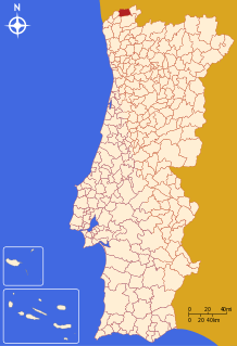
| Country | |
| Region | Norte |
| Intermunic. comm. | Alto Minho |
| District | Viana do Castelo |
| Parishes | 24 |
| Government | |
| • President | José Moreira (PS) |
| Area | |
| • Total | 211.31 km2 (81.59 sq mi) |
| Population (2011) | |
| • Total | 19,230 |
| • Density | 91/km2 (240/sq mi) |
| Time zone | UTC±00:00 (WET) |
| • Summer (DST) | UTC+01:00 (WEST) |
| Website | www |
Climate
Monção has a Hot-summer Mediterranean climate (Köppen: Csa) with mild, rainy winters and hot dry summers, although short, the dry season is dry enough to avoid being classified has an oceanic climate like nearby Vigo.
| Climate data for Monção (Valinha), 1971-2000 normals and extremes | |||||||||||||
|---|---|---|---|---|---|---|---|---|---|---|---|---|---|
| Month | Jan | Feb | Mar | Apr | May | Jun | Jul | Aug | Sep | Oct | Nov | Dec | Year |
| Record high °C (°F) | 22.2 (72.0) |
26.8 (80.2) |
28.7 (83.7) |
32.7 (90.9) |
34.5 (94.1) |
39.0 (102.2) |
42.0 (107.6) |
40.5 (104.9) |
38.5 (101.3) |
31.7 (89.1) |
25.0 (77.0) |
25.6 (78.1) |
42.0 (107.6) |
| Average high °C (°F) | 12.8 (55.0) |
14.7 (58.5) |
17.4 (63.3) |
18.6 (65.5) |
21.0 (69.8) |
25.4 (77.7) |
28.7 (83.7) |
28.9 (84.0) |
26.2 (79.2) |
20.6 (69.1) |
16.1 (61.0) |
13.5 (56.3) |
20.3 (68.6) |
| Daily mean °C (°F) | 8.6 (47.5) |
10.0 (50.0) |
12.0 (53.6) |
13.2 (55.8) |
15.6 (60.1) |
19.3 (66.7) |
22.0 (71.6) |
22.0 (71.6) |
19.9 (67.8) |
15.7 (60.3) |
11.8 (53.2) |
9.7 (49.5) |
15.0 (59.0) |
| Average low °C (°F) | 4.5 (40.1) |
5.4 (41.7) |
6.5 (43.7) |
7.8 (46.0) |
10.2 (50.4) |
13.1 (55.6) |
15.3 (59.5) |
14.9 (58.8) |
13.5 (56.3) |
10.7 (51.3) |
7.6 (45.7) |
6.0 (42.8) |
9.6 (49.3) |
| Record low °C (°F) | −5.2 (22.6) |
−3.0 (26.6) |
−3.0 (26.6) |
−2.0 (28.4) |
−0.5 (31.1) |
3.8 (38.8) |
7.5 (45.5) |
7.0 (44.6) |
4.0 (39.2) |
1.0 (33.8) |
−1.5 (29.3) |
−2.1 (28.2) |
−5.2 (22.6) |
| Average rainfall mm (inches) | 147.8 (5.82) |
125.7 (4.95) |
83.0 (3.27) |
100.7 (3.96) |
98.3 (3.87) |
49.8 (1.96) |
21.9 (0.86) |
24.0 (0.94) |
73.2 (2.88) |
134.9 (5.31) |
136.3 (5.37) |
182.9 (7.20) |
1,178.5 (46.39) |
| Average precipitation days (≥ 0.1 mm) | 16.2 | 14.0 | 13.1 | 14.7 | 14.0 | 8.7 | 6.1 | 5.4 | 8.6 | 14.2 | 14.6 | 15.5 | 145.1 |
| Source: Instituto de Meteorologia[3] | |||||||||||||
Notable people
- José Gomes Temporão, Minister of Health of Brazil
- Fernando Vilar, Uruguayan newsanchor
Population
| Population of Monção Municipality (1801–2011) | ||||||||
|---|---|---|---|---|---|---|---|---|
| 1801 | 1849 | 1900 | 1930 | 1960 | 1981 | 1991 | 2001 | 2011 |
| 12,095 | 14,983 | 26,077 | 24,585 | 27,393 | 23,799 | 21,799 | 19,956 | 19,230 |
Parishes
Administratively, the municipality is divided into 24 civil parishes (freguesias):[4]
- Abedim
- Anhões e Luzio
- Barbeita
- Barroças e Taias
- Bela
- Cambeses
- Ceivães e Badim
- Lara
- Longos Vales
- Mazedo e Cortes
- Merufe
- Messegães, Valadares e Sá
- Monção e Troviscoso
- Moreira
- Pias
- Pinheiros
- Podame
- Portela
- Riba de Mouro
- Sago, Lordelo e Parada
- Segude
- Tangil
- Troporiz e Lapela
- Trute
gollark: I can run it full-time now thanks to my server's GPU.
gollark: Besides, most of the quoting is done by the GPT-2 I trained on me.
gollark: Wrong.
gollark: I would, because it's true *and* convenient.
gollark: My facts are sourced from our in-house truth cuboids. They *cannot* be wrong.
See also
- Vinho Verde
- Brejoeira Palace
- Mercy Charitys's Church of Valadares
- Longos Vales's Monastery
- Castelo de Monção
References
- Instituto Nacional de Estatística
- "Áreas das freguesias, concelhos, distritos e país". Archived from the original on 2018-11-05. Retrieved 2018-11-05.
- "Monthly Averages for Valinha, Monção (1971–2000)" (PDF). Instituto de Meteorologia.
- Diário da República. "Law nr. 11-A/2013, pages 552 75-76" (pdf) (in Portuguese). Retrieved 28 July 2014.
External links
| Authority control |
|
|---|
This article is issued from Wikipedia. The text is licensed under Creative Commons - Attribution - Sharealike. Additional terms may apply for the media files.