Alto Minho
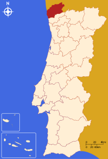
The Comunidade Intermunicipal do Alto Minho (Portuguese pronunciation: [ˈaɫtu ˈmiɲu]) is an administrative division in northern Portugal. It is situated between the Minho River and Lima River. It was created in October 2008.[1] Since January 2015, Alto Minho is also a NUTS3 subregion of Norte Region, that covers the same area as the intermunicipal community.[2] The main town of the intermunicipal community is Viana do Castelo. The intermunicipal community is coterminous with the former Viana do Castelo District. The population in 2011 was 244,836,[3] in an area of 2,218.84 km².[4]
Alto Minho | |
|---|---|
 | |
| Coordinates: 41°42′N 8°50′W | |
| Country | |
| Region | Norte |
| Established | 2008 |
| Seat | Viana do Castelo |
| Municipalities | 10 |
| Area | |
| • Total | 2,218.84 km2 (856.70 sq mi) |
| Population (2011) | |
| • Total | 244,836 |
| • Density | 110/km2 (290/sq mi) |
| Time zone | UTC±00:00 (WET) |
| • Summer (DST) | UTC+01:00 (WEST) |
| Website | www |
It borders to the north the Galicia autonomous region in Spain and to the south with the Cávado intermunicipal community. It is an area with a strong gastronomic identity and produces a specific type of wine called Vinho Verde (young wine).
Municipalities
It is composed of ten municipalities:[5]
| Municipality | Population (2011)[3] | Area (km²)[4] |
|---|---|---|
| Arcos de Valdevez | 22,847 | 447.60 |
| Caminha | 16,684 | 136.52 |
| Melgaço | 9,213 | 238.25 |
| Monção | 19,230 | 211.31 |
| Paredes de Coura | 9,198 | 138.19 |
| Ponte da Barca | 12,061 | 182.11 |
| Ponte de Lima | 43,498 | 320.25 |
| Valença | 14,127 | 117.13 |
| Viana do Castelo | 88,725 | 319.02 |
| Vila Nova de Cerveira | 9,253 | 108.47 |
| Total | 244,836 | 2,218.84 |
References
- CIM Alto Minho
- Adequação dos indicadores à nova organização territorial NUTS III / Entidades Intermunicipais, Instituto Nacional de Estatística, 18 March 2015
- Instituto Nacional de Estatística
- "Áreas das freguesias, concelhos, distritos e país". Archived from the original on 2018-11-05. Retrieved 2018-11-05.
- "Law nr. 75/2013" (pdf). Diário da República (in Portuguese). Assembly of the Republic (Portugal). Retrieved 18 August 2014.
External links
| Norte Region |
| ||||
|---|---|---|---|---|---|
| Centro Region |
| ||||
| Lisboa Region |
| ||||
| Alentejo Region |
| ||||
| Algarve Region |
| ||||
| Autonomous Regions | |||||
All these divisions are further subdivided into municipalities and parishes. | |||||