Mohpa
Mohpa is a city with a municipal council in Nagpur district in the Indian state of Maharashtra. Although physically located within Kalmeshwar taluka, it is not subject to taluka governance.
Mohpa | |
|---|---|
city | |
 Mohpa Location in Maharashtra, India | |
| Coordinates: 21°18′34″N 78°49′49″E | |
| Country | |
| State | Maharashtra |
| District | Nagpur |
| Taluka | Kalameshwar |
| Area | |
| • Total | 5.18 km2 (2.00 sq mi) |
| Elevation | 351 m (1,152 ft) |
| Population (2001) | |
| • Total | 7,066 |
| • Density | 1,400/km2 (3,500/sq mi) |
| Languages | |
| • Official | Marathi |
| Time zone | UTC+5:30 (IST) |
Geography
Mohpa is located on a tributary of the Chandrabhaga River.[2] It is 13 kilometres (8 mi) north-west of Kalmeshwar and 34 kilometres (21 mi) north-west of Nagpur. It has an average elevation of 351 metres (1151 feet).
History
Before 1955, Mohpa was a panchayat village,[1] but it was given municipal status that year,[3]
Demographics
As of 2001 India census, Mohpa had a population of 7,066.[4] Males constituted 51% of the population and females 49%. Mohpa had an average literacy rate of 74%, higher than the national average of 59.5%: male literacy was 81%, and female literacy was 66%. In Mohpa, 11% of the population was under 6 years of age.[5][6]
References
- "Municipalities". Nagpur District Gazetteer. 1966. Archived from the original on 10 April 2009.
- "Mohpa Town". Nagpur District Gazetteer. 1908. Archived from the original on 10 April 2009.
- Vide notification No. 1482-7825-M-B, 23 March 1955
- "2001 Alphabetical List of Towns and Their Population: Maharashtra" (PDF). Archived (PDF) from the original on 24 November 2007.
- "Census of India 2001: Data from the 2001 Census, including cities, villages and towns (Provisional)". Census Commission of India. Archived from the original on 16 June 2004. Retrieved 1 November 2008.
- 2001 Census Town Code = 40921000; 2011 Census Town Code = 802704
Nagpur district topics | |||||||||||||
|---|---|---|---|---|---|---|---|---|---|---|---|---|---|
| History | 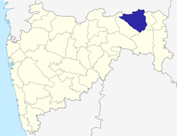 | ||||||||||||
| Geography | |||||||||||||
| Cities and towns | |||||||||||||
| Monuments | |||||||||||||
| Education |
| ||||||||||||
| Transport |
| ||||||||||||
| Constituencies |
| ||||||||||||