Mobaye Mbanga Airport
Mobaye Mbanga Airport (ICAO: FEFE) is an airport serving Mobaye, a town on the Ubangi River in the Basse-Kotto prefecture of the Central African Republic.
Mobaye Mbanga Airport | |||||||||||
|---|---|---|---|---|---|---|---|---|---|---|---|
| Summary | |||||||||||
| Airport type | Public | ||||||||||
| Serves | Mobaye, Central African Republic | ||||||||||
| Elevation AMSL | 1,332 ft / 406 m | ||||||||||
| Coordinates | 4°22′30″N 21°08′00″E | ||||||||||
| Map | |||||||||||
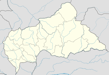 FEFE Location of Mobaye Mbanga Airport in the Central African Republic | |||||||||||
| Runways | |||||||||||
| |||||||||||
The airport is 7 kilometres (4.3 mi) downstream from the town, and south approach and departure might cross the river, which is locally the border with the Democratic Republic of the Congo.
The Gbadolite non-directional beacon (Ident: BLT) is located 6.8 nautical miles (12.6 km) southwest of the airport. The Gbadolite VOR-DME (Ident: BLT) is located 12.5 nautical miles (23.2 km) southwest of the airport.[4][5]
See also

- Transport in the Central African Republic
- List of airports in the Central African Republic
References
- Airport record for Mobaye Mbanga Airport at Landings.com. Retrieved 2013-08-26
- Google (2013-08-26). "location of Mobaye Mbanga Airport" (Map). Google Maps. Google. Retrieved 2013-08-26.
- Airport information for Mobaye Mbanga Airport at Great Circle Mapper.
- "Gbadolite NDB (BLT) @ OurAirports". ourairports.com. Retrieved 2018-08-20.
- "Gbadolite VOR-DME (BLT) @ OurAirports". ourairports.com. Retrieved 2018-08-20.
External links
- OpenStreetMap - Mobaye Mbanga Airport
- OurAirports - Mobaye Mbanga Airport
- FallingRain - Mobaye Mbanga Airport
- Accident history for Mobaye Mbanga Airport at Aviation Safety Network
This article is issued from Wikipedia. The text is licensed under Creative Commons - Attribution - Sharealike. Additional terms may apply for the media files.