Miyamori, Iwate
Miyamori (宮守村, Miyamori-mura) was a village located in Kamihei District, Iwate Prefecture, Japan.
Miyamori 宮守村 | |
|---|---|
Former municipality | |
 Flag | |
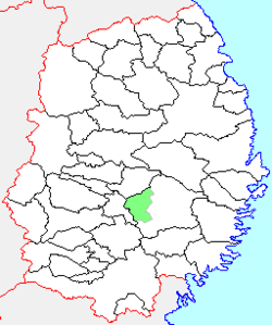 Location of Miyamori in Iwate Prefecture | |
 Miyamori Location in Japan | |
| Coordinates: 39°20′39.6″N 141°21′23.4″E | |
| Country | Japan |
| Region | Tōhoku |
| Prefecture | Iwate Prefecture |
| District | Kamihei District |
| Merged | October 1, 2005 (now part of Tōno) |
| Area | |
| • Total | 165.24 km2 (63.80 sq mi) |
| Population (September 30, 2005) | |
| • Total | 5,126 |
| • Density | 31.0/km2 (80/sq mi) |
| Symbols | |
| • Tree | Pinus densiflora |
| • Flower | Lilium auratum |
| • Bird | Japanese bush warbler |
| Time zone | UTC+9 (JST) |
History
The village of Miyamori was created on April 1, 1889 within Nishihei District with the establishment of the municipalities system. Nishihei was merged with Minamihei District to form Kamihei District on March 29, 1896. On February 11, 1955, Miyamori annexed the neighboring villages of Tassobe and Masuzawa.
On October 1, 2005, Miyamori was merged into the expanded city of Tōno and no longer exists as an independent municipality.
On September 30, 2005, the village had an estimated population of 5,162 and a population density of 31.0 persons per km2. The total area was 165.24 km2.
gollark: Think of all the poor general channel users.
gollark: Posting memes in a general channel because of one staff member is fairly apiohazardous.
gollark: Firefox's spellcheck says counselor for some reason, hm.
gollark: I think you mean counsellor.
gollark: "I don't care if you hold [VIEW] but don't talk about it, mention it in any way or act according to [VIEW]".
External links
- Official website of Tōno (in Japanese)
| Authority control |
|
|---|
This article is issued from Wikipedia. The text is licensed under Creative Commons - Attribution - Sharealike. Additional terms may apply for the media files.