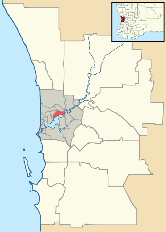
Mirrabooka, Western Australia
Mirrabooka is a suburb of Perth, Western Australia. Its local government area is the City of Stirling.
| Mirrabooka Perth, Western Australia | |||||||||||||||
|---|---|---|---|---|---|---|---|---|---|---|---|---|---|---|---|
 Mirrabooka | |||||||||||||||
| Coordinates | 31.863°S 115.87°E | ||||||||||||||
| Population | 7,933 (2011 census)[1] | ||||||||||||||
| • Density | 1,587/km2 (4,110/sq mi) | ||||||||||||||
| Established | 1954 | ||||||||||||||
| Postcode(s) | 6061 | ||||||||||||||
| Area | 5.0 km2 (1.9 sq mi) | ||||||||||||||
| Location | 12 km (7 mi) N of Perth CBD | ||||||||||||||
| LGA(s) | City of Stirling | ||||||||||||||
| State electorate(s) | Mirrabooka | ||||||||||||||
| Federal Division(s) | Stirling | ||||||||||||||
| |||||||||||||||
Mirrabooka is an Aboriginal name for the constellation most commonly known as the Southern Cross.[2]
The early stage of development of the suburb was originally as an extension of Girrawheen[3] and Nollamara.[4]
The suburb has expanded rapidly in recent years, with the subdivision of bushland, on which housing developments have been built,[5] especially north of Yirrigan Drive.
The Mirrabooka Square Shopping Centre developed in 1979[6] has been expanded. The new regional police station of the Western Australia Police was expanded in 2015.[7]
Transport
The suburb is home to the Mirrabooka bus station,[8] a hub for bus transport in the area, and is served by a number of Transperth bus routes operated by Path Transit and Swan Transit, including connections to Perth, Warwick railway station and Stirling.
For the part north of Reid Highway, the western end on Mirrabooka Avenue is covered by routes 374 and 376. Route 377 runs in Honeywell Boulevard, and route 378 runs in Australis Avenue; the eastern end on Alexander Drive is covered by routes 360, 361 and 362; the northern end on Beach Road is covered by route 449. All of these services are operated by Path Transit except route 374, which is operated by Swan Transit.
Schools
- Boyare Primary School (1991)
- Dryandra Primary School (1989)
- John Septimus Roe Anglican Community School (1990)
References
- Australian Bureau of Statistics (31 October 2012). "State Suburbs: Mirrabooka (WA)". 2011 Census QuickStats. Retrieved 5 October 2008.

- Western Australian Land Information Authority (3 June 2016). "Perth suburb names". Retrieved 16 July 2016.
- Margaret A. Feilman & Associates; State Housing Commission of Western Australia (1970), Mirrabooka Project, Girrawheen neighbourhood. Sheet 22 : State Housing Commission W. Australia (Rev. [ed.] ed.), State Housing Commission, retrieved 20 September 2016
- Margaret A. Feilman Architects & Planners; State Housing Commission of Western Australia (1960), Mirrabooka project...Nollamara neighbourhood, Margaret A. Feilman, retrieved 20 September 2016
- Sinclair, Knight & Partners; State Housing Commission of Western Australia (1985), Mirrabooka Regional Centre : parking study report, Sinclair Knight & Partners (W.A.) Pty. Ltd. Consulting Engineers, retrieved 20 September 2016
- Metropolitan (Perth) Passenger Transport Trust (1979), Mirrabooka Bus Station : commences operation Monday, 17th September, 1979, retrieved 20 September 2016
- http://www.pfeng.com.au/projects/structural-engineering/justice-correctional-services/mirrabooka-police-station/.
- Metropolitan (Perth) Passenger Transport Trust (1979), Mirrabooka Bus Station : commences operation Monday, 17th September, 1979, retrieved 20 September 2016
