Mirobod
Mirobod is one of 11 districts (tuman) of Tashkent, the capital of Uzbekistan.
Mirobod | |
|---|---|
 | |
| Country | |
| Municipality | Tashkent |
| Established | 1981 |
| Area | |
| • Total | 17.1 km2 (6.6 sq mi) |
| Population (2009)[1] | |
| • Total | 122,700 |
| • Density | 7,200/km2 (19,000/sq mi) |
Overview
It is one of the central district of the city and was established in 1981 with the name of Lenin,[2] referring to the famous Russian communist leader Vladimir Lenin.
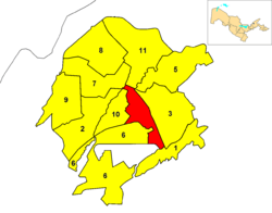
Mirobod borders with the districts of Sergeli, Yakkasaray, Yunusabad, Hamza and Bektemir.
gollark: And still is due to environment accursedness.
gollark: It was at the time.
gollark: PotatOS doesn't have one.
gollark: I do NOT want to have to reinvent Dragon.
gollark: Is there a 1.16-compatible storage system supporting multiple terminals nowadays?
References
- (in Russian) Statistics of the subdivisions of Tashkent
- Sadikov, A C; Akramob Z. M., Bazarbaev, A., Mirzlaev T.M., Adilov S. R., Baimukhamedov X. N., et al. (in Russian) (72x112). Geographical Atlas of Tashkent (Ташкент Географический Атлас) (2 ed.). Moscow. p. 64.
External links
| Landmarks | |||
|---|---|---|---|
| Districts | |||
This article is issued from Wikipedia. The text is licensed under Creative Commons - Attribution - Sharealike. Additional terms may apply for the media files.