Mineyama Domain
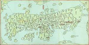
Mineyama Domain (峯山藩, Mineyama han) was a Japanese domain of the Edo period. It was associated with Tango Province in modern-day Kyoto Prefecture.[1]
In the han system, Mineyama was a political and economic abstraction based on periodic cadastral surveys and projected agricultural yields.[2] In other words, the domain was defined in terms of kokudaka, not land area.[3] This was different from the feudalism of the West.
List of daimyōs
The hereditary daimyōs were head of the clan and head of the domain.

- Takamichi (1603–1665)[4]
- Takatomo (高供)
- Takaaki
- Takayuki
- Takanaga
- Takahisa
- Takamasa
- Takamasu
- Takatsune
- Takakage
- Takatomi
- Takanobu
gollark: It's iscosoles (how do you spell that) because radii.
gollark: Just split it into two right angled triangles. Easy.
gollark: So it's 1/10 * 1/10 = 1/100.
gollark: The probability of two independent events both occurring is the probabilities of each multiplied together.
gollark: I think the axioms are satisfied fine if you just remove all numbers except 0.
See also
- List of Han
- Abolition of the han system
References

- "Echigo Province" at JapaneseCastleExplorer.com; retrieved 2013-4-8.
- Mass, Jeffrey P. and William B. Hauser. (1987). The Bakufu in Japanese History, p. 150.
- Elison, George and Bardwell L. Smith (1987). Warlords, Artists, & Commoners: Japan in the Sixteenth Century, p. 18.
- Papinot, Jacques Edmond Joseph. (1906). Dictionnaire d'histoire et de géographie du Japon; Papinot, (2003). "Kyōgoku" at Nobiliare du Japon, p. 28; retrieved 2013-4-8.
This article is issued from Wikipedia. The text is licensed under Creative Commons - Attribution - Sharealike. Additional terms may apply for the media files.