Mesa, Washington
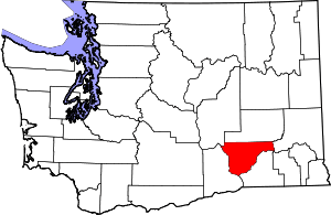
Mesa (/ˈmiːsə/) is a city in Franklin County, Washington, United States. The population was 489 at the 2010 census. The Washington State Office of Financial Management's 2018 estimate placed the population at 513.
Mesa | |
|---|---|
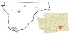
 Location of Mesa, Washington | |
| Coordinates: 46°34′37″N 119°0′9″W | |
| Country | United States |
| State | Washington |
| County | Franklin |
| Area | |
| • Total | 1.66 sq mi (4.29 km2) |
| • Land | 1.66 sq mi (4.29 km2) |
| • Water | 0.00 sq mi (0.00 km2) |
| Elevation | 689 ft (210 m) |
| Population | |
| • Total | 489 |
| • Estimate (2019)[3] | 508 |
| • Density | 306.58/sq mi (118.39/km2) |
| Time zone | UTC-8 (Pacific (PST)) |
| • Summer (DST) | UTC-7 (PDT) |
| ZIP code | 99343 |
| Area code(s) | 509 |
| FIPS code | 53-45180 |
| GNIS feature ID | 1512459[4] |
History
Originally called Bluff Wells, then Judson, now Mesa was a stop on the Ainsworth (now Pasco) to Spokane branch of the Northern Pacific Railroad. It was the stop between Eltopia and Palouse Junction (now Connell). The station was established in 1883.
The Columbia Basin Irrigation Project brought water to the area in 1948. Prior to this development, people relied on either private wells or the railroad well at Mesa. Mesa was officially incorporated on June 23, 1955. Today, Mesa is a small town supported by dryland farming, irrigated farming, and livestock.
Geography
Mesa is located at 46°34′37″N 119°0′9″W (46.576963, -119.002516).[5]
According to the United States Census Bureau, the city has a total area of 1.64 square miles (4.25 km2), all of it land.[6]
Demographics
| Historical population | |||
|---|---|---|---|
| Census | Pop. | %± | |
| 1960 | 263 | — | |
| 1970 | 274 | 4.2% | |
| 1980 | 278 | 1.5% | |
| 1990 | 252 | −9.4% | |
| 2000 | 425 | 68.7% | |
| 2010 | 489 | 15.1% | |
| Est. 2019 | 508 | [3] | 3.9% |
| U.S. Decennial Census[7] 2018 Estimate[8] | |||
2010 census
As of the census[2] of 2010, there were 489 people, 124 households, and 106 families residing in the city. The population density was 298.2 inhabitants per square mile (115.1/km2). There were 128 housing units at an average density of 78.0 per square mile (30.1/km2). The racial makeup of the city was 67.7% White, 1.6% African American, 0.4% Native American, 0.4% Asian, 26.8% from other races, and 3.1% from two or more races. Hispanic or Latino of any race were 75.3% of the population.
There were 124 households of which 66.1% had children under the age of 18 living with them, 58.1% were married couples living together, 14.5% had a female householder with no husband present, 12.9% had a male householder with no wife present, and 14.5% were non-families. 9.7% of all households were made up of individuals and 2.4% had someone living alone who was 65 years of age or older. The average household size was 3.94 and the average family size was 4.08.
The median age in the city was 23.8 years. 36.8% of residents were under the age of 18; 15.4% were between the ages of 18 and 24; 27.6% were from 25 to 44; 16.5% were from 45 to 64; and 3.7% were 65 years of age or older. The gender makeup of the city was 51.1% male and 48.9% female.
2000 census
As of the census of 2000, there were 425 people, 105 households, and 91 families residing in the city. The population density was 268.7 people per square mile (103.9/km²). There were 111 housing units at an average density of 70.2 per square mile (27.1/km²). The racial makeup of the city was 58.59% White, 0.94% Native American, 0.47% Asian, 28.24% from other races, and 11.76% from two or more races. Hispanic or Latino of any race were 59.29% of the population.
There were 105 households out of which 64.8% had children under the age of 18 living with them, 71.4% were married couples living together, 5.7% had a female householder with no husband present, and 13.3% were non-families. 7.6% of all households were made up of individuals and 4.8% had someone living alone who was 65 years of age or older. The average household size was 4.05 and the average family size was 4.15.
In the city, the age distribution of the population shows 42.6% under the age of 18, 11.1% from 18 to 24, 30.4% from 25 to 44, 10.1% from 45 to 64, and 5.9% who were 65 years of age or older. The median age was 22 years. For every 100 females, there were 105.3 males. For every 100 females age 18 and over, there were 110.3 males.
The median income for a household in the city was $38,750, and the median income for a family was $39,583. Males had a median income of $28,250 versus $21,250 for females. The per capita income for the city was $18,882. About 9.0% of families and 15.1% of the population were below the poverty line, including 14.4% of those under age 18 and none of those age 65 or over.
Current events
In 2008, the city was involved in litigation with former mayor and councilwoman Donna Zink over incorrectly handled public document requests under Washington State's Public Records Act. A Superior Court judge has ruled that the town of Mesa must pay its former mayor about $230,000 after losing the long-running dispute.[9]
References
- "2019 U.S. Gazetteer Files". United States Census Bureau. Retrieved August 7, 2020.
- "U.S. Census website". United States Census Bureau. Retrieved 2012-12-19.
- "Population and Housing Unit Estimates". United States Census Bureau. May 24, 2020. Retrieved May 27, 2020.
- "US Board on Geographic Names". United States Geological Survey. 2007-10-25. Retrieved 2008-01-31.
- "US Gazetteer files: 2010, 2000, and 1990". United States Census Bureau. 2011-02-12. Retrieved 2011-04-23.
- "US Gazetteer files 2010". United States Census Bureau. Archived from the original on 2012-01-24. Retrieved 2012-12-19.
- United States Census Bureau. "Census of Population and Housing". Retrieved August 29, 2013.
- "Population Estimates". United States Census Bureau. Retrieved June 8, 2018.
- "Archived copy". Archived from the original on 2008-11-23. Retrieved 2008-11-23.CS1 maint: archived copy as title (link)
