McKee Township, Adams County, Illinois
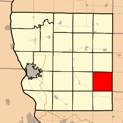
McKee Township is one of twenty-two townships in Adams County, Illinois, United States. As of the 2010 census, its population was 171 and it contained 115 housing units.[2]
McKee Township | |
|---|---|
 Location in Adams County | |
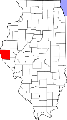
 Adams County's location in Illinois | |
| Coordinates: 39°53′00″N 91°00′01″W | |
| Country | United States |
| State | Illinois |
| County | Adams |
| Established | November 6, 1849 |
| Area | |
| • Total | 36.11 sq mi (93.5 km2) |
| • Land | 35.86 sq mi (92.9 km2) |
| • Water | 0.24 sq mi (0.6 km2) 0.66% |
| Elevation | 610 ft (186 m) |
| Population (2010) | |
| • Estimate (2016)[1] | 169 |
| • Density | 4.8/sq mi (1.9/km2) |
| Time zone | UTC-6 (CST) |
| • Summer (DST) | UTC-5 (CDT) |
| ZIP codes | 62320, 62324, 62347 |
| FIPS code | 17-001-45746 |
Geography
According to the 2010 census, the township has a total area of 36.11 square miles (93.5 km2), of which 35.86 square miles (92.9 km2) (or 99.31%) is land and 0.24 square miles (0.62 km2) (or 0.66%) is water.[2]
Unincorporated towns
Cemeteries
The township contains twelve cemeteries: Burden, Durbin, Fairview, Goertz, Grady, Harwood, Lierly, Padgett, Perrigo, Spring Valley, Stevens and Whiaker.
Lakes
- Crabapple Lake
Landmarks
School districts
- Camp Point Community Unit School District 3
- Liberty Community Unit School District 2
Political districts
- Illinois' 18th congressional district
- State House District 93
- State Senate District 47
gollark: ?remind 3d @[ʇɔǝɾqO ʇɔǝɾqo], 3 days ago: for each of these you receive, ?remind twicehttps://discordapp.com/channels/346530916832903169/348702212110680064/505092741407965226
gollark: ?remind 3d @[ʇɔǝɾqO ʇɔǝɾqo], 3 days ago: for each of these you receive, ?remind twicehttps://discordapp.com/channels/346530916832903169/348702212110680064/505092741407965226
gollark: Except it's not much of a "republic" now.
gollark: Write it in Rust.
gollark: Hmm, I should rename WHYJIT to WHERE, good idea.
References
- "McKee Township, Adams County, Illinois". Geographic Names Information System. United States Geological Survey. Retrieved 2010-01-04.
- United States Census Bureau 2007 TIGER/Line Shapefiles
- United States National Atlas
- "Population and Housing Unit Estimates". Retrieved June 9, 2017.
- "Population, Housing Units, Area, and Density: 2010 - County -- County Subdivision and Place -- 2010 Census Summary File 1". United States Census. Archived from the original on 2020-02-12. Retrieved 2013-05-28.
- "Census of Population and Housing". Census.gov. Retrieved June 4, 2016.
This article is issued from Wikipedia. The text is licensed under Creative Commons - Attribution - Sharealike. Additional terms may apply for the media files.