Matakong
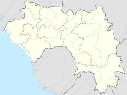
Matakong is an island just off the coast of Guinea between the capital Conakry and the Sierra Leone border.
Matakong, Forécariah Prefecture | |
|---|---|
 Matakong, Forécariah Prefecture Location in Guinea | |
| Coordinates: 09°16′20″N 13°25′20″W | |
| Country | Guinea |
| Prefecture | Forécariah Prefecture |
| Elevation | 3 ft (1 m) |
Nomenclature
Matakong is also called Matakan.
Transport
Matakong is the proposed port terminus of the heavy duty standard gauge Trans-guinean Railways linking large iron and bauxite deposits to the coast. The proposed Bellzone iron ore mine at Kalia may also share this railway line.[1]
New port
A new deep water port is needed because, firstly, the port at Conakry is built out and there is no room, and secondly, because a new port at Matakong has better access though flatter ground to the hinterland.
A 20 km pier may be needed to reach deep water.
gollark: As an elite h4xx0r I can just parse HTML, the best programming language, in my head.
gollark: I use curl vsomething.
gollark: If I can just decrypt the SODIMMs with ASCII…
gollark: That's so insulting that I'm synthesizing a PCI panel to take down your SDRAM.
gollark: Then compile a 56k RX database.
See also
- Transport in Guinea
- Railway stations in Guinea
- List of deep water ports (void)
- List of Panamax ports
References
- "Archived copy". Archived from the original on 2009-10-13. Retrieved 2010-05-28.CS1 maint: archived copy as title (link)
This article is issued from Wikipedia. The text is licensed under Creative Commons - Attribution - Sharealike. Additional terms may apply for the media files.