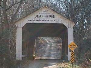
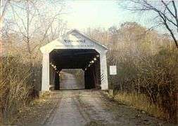
Marshall Covered Bridge
The Marshall Covered Bridge is a single span Burr arch truss covered bridge structure that was built by Joseph A. Britton & Son in 1917. The bridge is 74 ft (23 m) long, 15 ft (4.6 m) wide, and 14 ft (4.3 m) high.[3][4]
Marshall Covered Bridge | |
|---|---|
 | |
| Coordinates | 39.88346°N 87.32629°W |
| Carries | C.R. 800N |
| Crosses | Rush Creek |
| Locale | Liberty, Indiana |
| Named for | Mahlon Marshall or David W. Marshall |
| Owner | Parke County Commissioners Parke County |
| NBI Number | 6100155[1] |
| Characteristics | |
| Design | Burr Arch truss single-span bridge |
| Material | Wood |
| Total length | 74 feet (23 m) |
| Width | 15 feet (4.6 m) |
| Height | 13 feet (4.0 m) |
| Load limit | 5 tonnes (11,000 lb) |
| History | |
| Constructed by | Joseph A. Britton |
| Construction cost | <$680 |
| Opened | 1917 |
| Statistics | |
| Daily traffic | 50 |
Marshall Bridge | |
| MPS | Parke County Covered Bridges TR |
| NRHP reference No. | 78000400[2] |
| Added to NRHP | December 22, 1978 |
 Marshall Covered Bridge Location in Indiana | |
It was added to the National Register of Historic Places in 1978.[2]
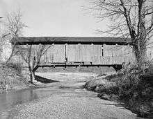
Gallery
 Marshall Bridge in the mid-1990s
gollark: * DICTIONATOR™™
gollark: Hold on while I hack into the dictionary.
gollark: Although if any non-native speakers or something have trouble understanding me because of words like SHOPPINGPLACE™ they should tell me so I can avoid them.
gollark: And guess what? You understand words like SHOPPINGPLACE™ perfectly!
gollark: Anyway, in a very real sense, "English" is defined by what people actually speak/write/understand in the wild.
See also
- List of Registered Historic Places in Indiana
- Parke County Covered Bridges
- Parke County Covered Bridge Festival
References
- http://nationalbridges.com/
- "National Register Information System". National Register of Historic Places. National Park Service. January 23, 2007.
- "Marshall Covered Bridge (#29)". coveredbridges.com. Parke County Incorporated / Parke County Convention and Visitors Commission. Retrieved 21 September 2016.
- "Indiana State Historic Architectural and Archaeological Research Database (SHAARD)" (Searchable database). Department of Natural Resources, Division of Historic Preservation and Archaeology. Retrieved 2016-06-01. Note: This includes Charles Felkner (December 1977). "National Register of Historic Places Inventory Nomination Form: Parke County Covered Bridge Historic District" (PDF). Retrieved 2016-06-01., Site map, and Accompanying photographs.
This article is issued from Wikipedia. The text is licensed under Creative Commons - Attribution - Sharealike. Additional terms may apply for the media files.


