Maromitety
Maromitety is a town and commune (Malagasy: kaominina) in Madagascar. It belongs to the district of Vavatenina, which is a part of Analanjirofo Region. The population of the commune was estimated to be approximately 18,000 in 2001 commune census.[2]
Maromitety | |
|---|---|
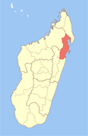
 Maromitety Location in Madagascar | |
| Coordinates: 17°29′S 49°17′E | |
| Country | |
| Region | Analanjirofo |
| District | Vavatenina |
| Elevation | 177 m (581 ft) |
| Population (2001)[2] | |
| • Total | 18,000 |
| Time zone | UTC3 (EAT) |
Only primary schooling is available. The majority 96% of the population of the commune are farmers. The most important crop is rice, while other important products are bananas, coffee and cloves. Services provide employment for 4% of the population.[2]
References and notes
- Estimated based on DEM data from Shuttle Radar Topography Mission
- "ILO census data". Cornell University. 2002. Retrieved 2008-03-08.
| Fenerive Est |
|  |
|---|---|---|
| Mananara Nord |
| |
| Maroantsetra |
| |
| Sainte Marie | ||
| Soanierana Ivongo |
| |
| Vavatenina | ||
gollark: Ah yes, a "vocational" school or something.
gollark: It's amazing, he somehow manages to cover up the bad things he does by just doing worse things.
gollark: Yes, orange man is extremely bad and æ.
gollark: The US is like a country, but it's stupid.
gollark: In total, fewer than 5% of people are.
This article is issued from Wikipedia. The text is licensed under Creative Commons - Attribution - Sharealike. Additional terms may apply for the media files.