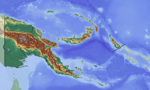
Maramuni Rural LLG
Maramuni Rural LLG is a local-level government (LLG) of Enga Province, Papua New Guinea.[1][2]
Maramuni Rural LLG | |
|---|---|
 Maramuni Rural LLG Location within Papua New Guinea | |
| Coordinates: 5.13674°S 143.488535°E | |
| Country | Papua New Guinea |
| Province | Enga Province |
| Time zone | UTC+10 (AEST) |
Wards
- 01. Biak
- 02. Net Nai
- 03. Pasalaugus
- 04. Wailep
- 05. Tongori
- 06. Kaematok
- 07. Wangalongen
- 08. Neliyakou
- 09. Ilya
- 10. Poreak
- 11. Warakom
- 12. Pokale
- 13. Penale
gollark: Which is a repurposed desktop.
gollark: It's on one of my "servers".
gollark: The old version of it was actually written in Rust, but I'm not very good at that so I rewrote it.
gollark: It's actually on github too: https://github.com/osmarks/autobotrobot
gollark: My bot has about 300 lines of code, and it has... a fortune command, `++delete` (a joke one which just says "Deleted [whatever you typed]" and adds it to the deleted items list), a command to list recently "deleted" things, a command to run various esolangs and stuff using TIO.run, and a reminder thing.
References
- "Census Figures by Wards - Highlands Region". www.nso.gov.pg. 2011 National Population and Housing Census: Ward Population Profile. Port Moresby: National Statistical Office, Papua New Guinea. 2014.
- "Final Figures". www.nso.gov.pg. 2011 National Population and Housing Census: Ward Population Profile. Port Moresby: National Statistical Office, Papua New Guinea. 2014.
- OCHA FISS (2018). "Papua New Guinea administrative level 0, 1, 2, and 3 population statistics and gazetteer". Humanitarian Data Exchange. 1.31.9.
- United Nations in Papua New Guinea (2018). "Papua New Guinea Village Coordinates Lookup". Humanitarian Data Exchange. 1.31.9.
This article is issued from Wikipedia. The text is licensed under Creative Commons - Attribution - Sharealike. Additional terms may apply for the media files.