Manhiça District
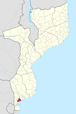
Manhiça District is a district of Maputo Province in southern Mozambique. The principal town is Manhiça. The district is located in the north of the province, and borders with Magude District in the north, Bilene Macia District of Gaza Province in the northeast, Marracuene District and the city of Maputo in the south, and with Moamba District in the west. In the east, the district is limited by the Indian Ocean. The area of the district is 2,373 square kilometres (916 sq mi).[1] It has a population of 159,812 as of 2007.[2]
Manhiça | |
|---|---|
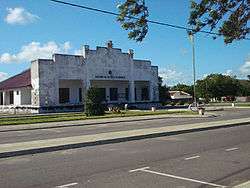
 Building of the district administration | |
 Manhiça District on the map of Mozambique | |
| Country | Mozambique |
| Province | Maputo |
| Capital | Manhiça |
| Area | |
| • Total | 2,373 km2 (916 sq mi) |
| Population (2007 census) | |
| • Total | 159,812 |
| • Density | 67/km2 (170/sq mi) |
Geography
The principal river in the district is the Komati River. The biggest lake is Lake Chuáli.[1]
The climate is tropical humid at the coast, and tropical dry in the interior, with the annual rainfall being 807 millimetres (31.8 in).[1]
History
The name of the district originates from Manacusse, a Tchaka chief, who moved here after some conflict in his native area, currently in South Africa.[1]
Demographics
As of 2005, 41% of the population of the district was younger than 15 years. 45% of the population spoke Portuguese. The most common mothertongue among the population was Xichangana. 58% were analphabetic, mostly women.[1]
Administrative divisions
The district is divided into six postos, Manhiça (three localities), Xinavane (three localities), 3 de Fevereiro (three localities), Calanga (two localities), Maluana (two localities), and Ilha Josina Machel (two localities).[1]
Economy
The town of Manhiça is notable for the research center CISM (Centro de Investigacao em Saude em Manhica) and the Manhiça District Hospital, both institutions work closely together. The CISM receives several international students each year. Manhiça lies northwest of the capital city Maputo.
Agriculture
In the district, there are 28,000 farms which have on average 1.2 hectares (0.0046 sq mi) of land. The main agricultural products are corn, cassava, cowpea, peanut, and sweet potato.[1]
Transportation
There is a road network in the district of the total length of about 200 kilometres (120 mi), which includes a stretch of the national road EN1, running from Maputo along the coast to the north of Mozambique.[1]
References
- "Perfil do Distrito da Manhiça" (PDF) (in Portuguese). Ministry of State Administration. 2005. Archived from the original (PDF) on 15 February 2017. Retrieved 30 October 2016.
- "População da Provincia de Maputo". Censo 2007 (in Portuguese). Instituto Nacional de Estatística. Archived from the original on 20 February 2008. Retrieved 20 March 2008.