Mandiavato
Mandiavato is a town and commune in Madagascar. It belongs to the district of Miarinarivo, which is a part of Itasy Region. The population of the commune was estimated to be approximately 20,000 in 2001 commune census.[2]
Mandiavato | |
|---|---|
 Mandiavato Location in Madagascar | |
| Coordinates: 19°5′S 47°1′E | |
| Country | |
| Region | Itasy |
| District | Miarinarivo |
| Elevation | 1,502 m (4,928 ft) |
| Population (2001)[2] | |
| • Total | 20,000 |
| • Ethnicities | Merina |
| Time zone | UTC3 (EAT) |
Primary and junior level secondary education are available in town. It is also a site of industrial-scale mining. The majority 98% of the population of the commune are farmers. The most important crop is rice, while other important products are vegetables and cassava. Services provide employment for 2% of the population.[2]
References and notes
- Estimated based on DEM data from Shuttle Radar Topography Mission
- "ILO census data". Cornell University. 2002. Retrieved 2008-04-23.
| Arivonimamo | 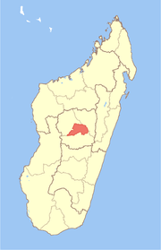 | |
|---|---|---|
| Miarinarivo | ||
| Soavinandriana | ||
gollark: The not-sold-as-reusable ones actually can last for a while. We have loads of them around at home for shopping.
gollark: Computerized voting: because computer systems never have big security problems, and trusting elections to closed source voting machines is totally fine!
gollark: I'm not sure why the presidential candidates' age needs to be brought into this when they all seem bad in other ways anyway.
gollark: That would make sense.
gollark: I'm not hip and with it (yo) when it comes to all these... generation name things? What's a "doomer"?
This article is issued from Wikipedia. The text is licensed under Creative Commons - Attribution - Sharealike. Additional terms may apply for the media files.