Arivonimamo II
Arivonimamo II is a town and commune in Madagascar. It belongs to the district of Arivonimamo, which is a part of Itasy Region. The population of the commune was estimated to be approximately 10,000 in 2001 commune census.[2]
Arivonimamo II | |
|---|---|
 Arivonimamo II Location in Madagascar | |
| Coordinates: 18°58′S 47°11′E | |
| Country | |
| Region | Itasy |
| District | Arivonimamo |
| Elevation | 1,373 m (4,505 ft) |
| Population (2001)[2] | |
| • Total | 10,000 |
| • Ethnicities | Merina |
| Time zone | UTC3 (EAT) |
Only primary schooling is available. The majority 99.5% of the population of the commune are farmers. The most important crops are rice and tomato, while other important agricultural products are cucumber, cassava and potatoes. Services provide employment for 0.5% of the population.[2]
References and notes
- Estimated based on DEM data from Shuttle Radar Topography Mission
- "ILO census data". Cornell University. 2002. Retrieved 2008-04-23.
| Arivonimamo | 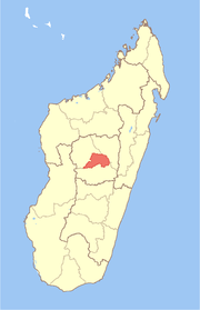 | |
|---|---|---|
| Miarinarivo | ||
| Soavinandriana | ||
gollark: why dont you upgrade to windows 7
gollark: ew windows 10
gollark: Can't you just use remote desktop and not add a mönitor?
gollark: Ah. WinDOS.
gollark: Ah, so sort of a KVM switch as weird proprietary software.
This article is issued from Wikipedia. The text is licensed under Creative Commons - Attribution - Sharealike. Additional terms may apply for the media files.